Off to the Canyon

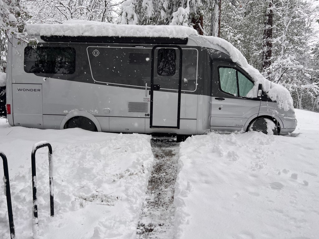
Yesterday, we headed out late morning after a 2 day dig in the snow. We made it to Orange Grove RV park just south of Bakersfield by 7 o’clock. Enroute to the Grand Canyon south rim where we plan to spend 4 days hiking down into (and out of).

Digging out

This morning, we walked around the park picking oranges (yes, it isan Orange grove) with my cousin, who rendezvoused with us there on his route north. Fun to see them. Rving in their 80’s and had delicious oranges too

We proceeded east over Tehachapi via Barstow to Amboy crater.  

We stopped in Barstow for fuel and had a “Barstow Walmart“ experience.  Hard to describe that in an email, you had to be there.

 Amboy crater is on the eastern side of the Mojave desert on the old route 66 highway,an old cinder cone from many eons ago. We shouldered our canyon backpacks as a little preliminary hike before heading out to the Grand Canyon. 4 miles later we felt pretty confident that we could do the canyon 

Up on top
Treacherous narrow rim. It gets worse.

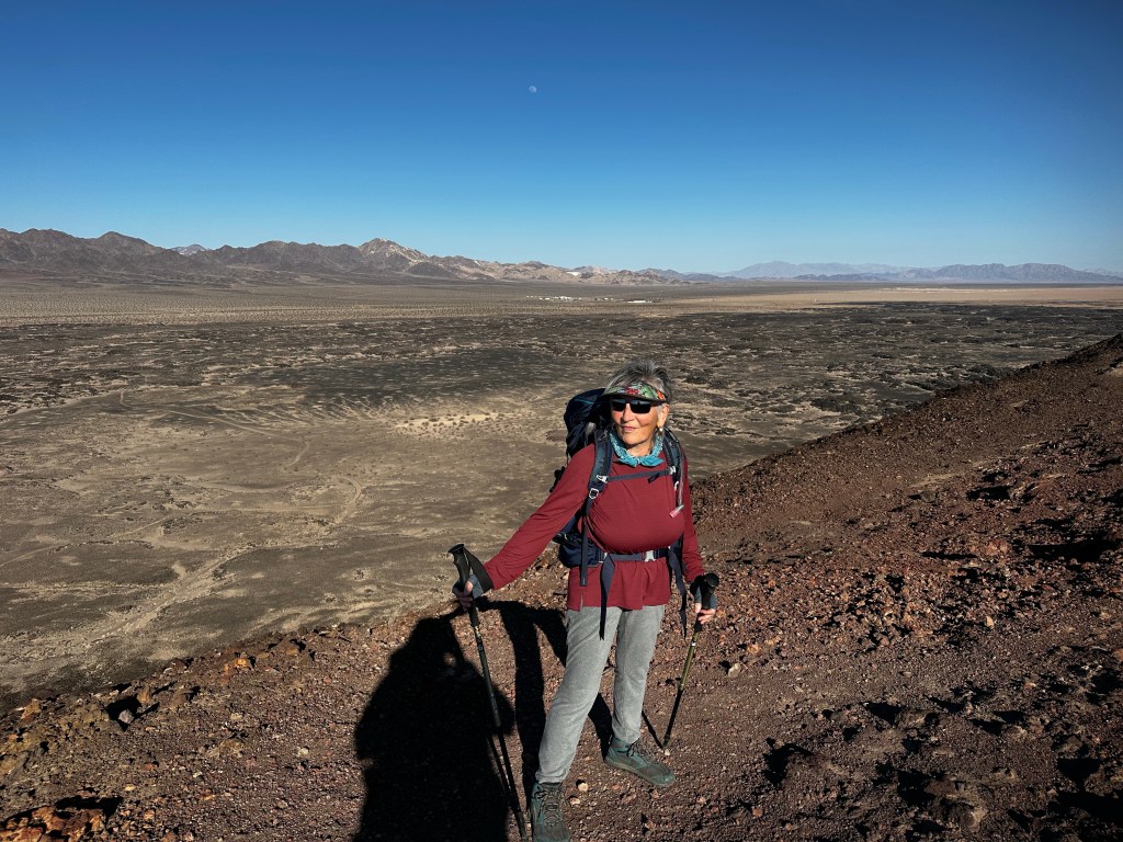
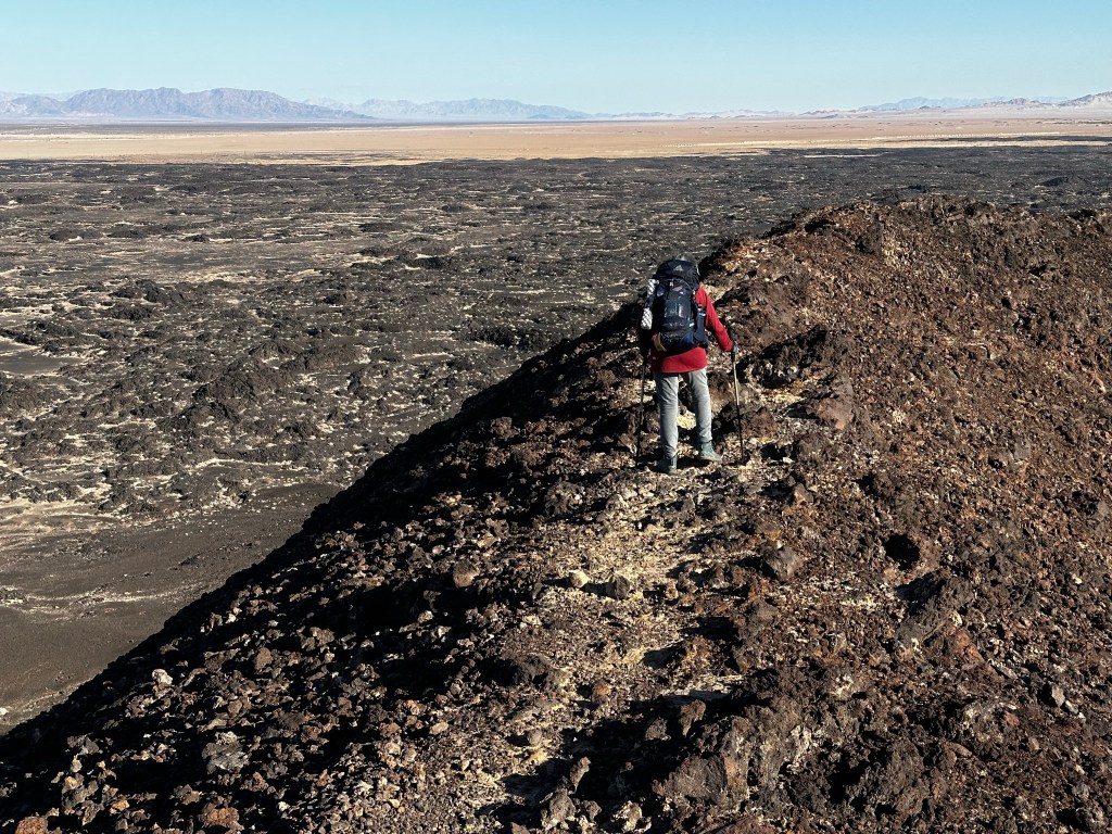
That’s is that is assuming we could stay upright. Very steep and narrow. Easy without the packs, Treacherous (never again) with. 

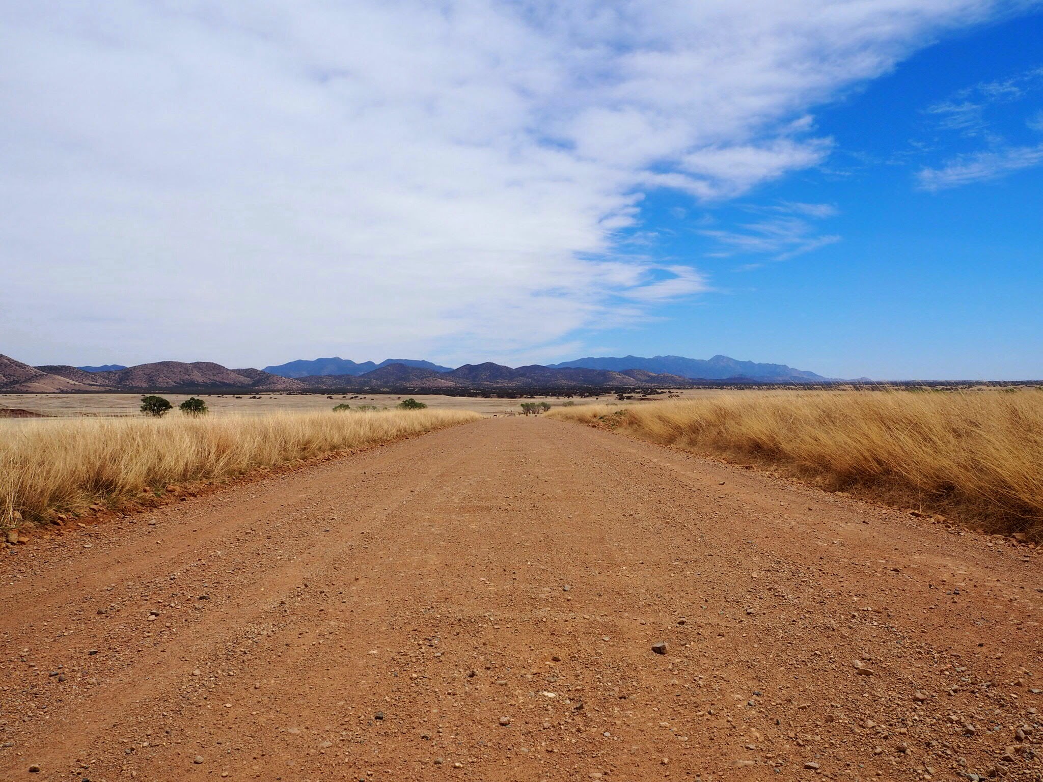
Now, as the evening sun sets over the Mojave desert, and the golden light illuminates the beautiful boulders and dry landscape, we proceed along the highway down the hill towards the Colorado river atNeedles, California (also known as to us as Noodles,California), where are we will encamp for the night

Tomorrow we head up to the Canyon. We will encamp I’m Trailer village. Hi temp is 40, low is 20 or well 🙈. From experience we think if we keep plugged in with heater on, we will be ok. Daytime above freezing and☀️☀️to warm the van.

Prayers willingly accepted. (Memo to Kent: “what were you thinking when you omitted to this?”)

More later, assuming we don’t get run off the road by sleepy truck drivers on I-40. Ah, the life. 

Sraddha and Kent

Welcome to Chez Swell. Sand is our specialty.

In Chez Swell, located in the the San Rafael Swell in central Utah, we have a smorgasbord of sand for your delight. You can look at it, walk on it, wipe it out of your eyes and ears, shake it out of shoes, clothing, car, van, bed, dishes, brush it off your phone, wash it off your bike.

Basically it is everywhere. And the wind tunnel that is central and southern utah ( and frankly most of western USA, delivers it in very fun ways.

Up near Temple Mountain in the San Rafael Swell, Utah

The flavors vary depending upon location. The whole Colorado plateau encompassing western Colorado, southern Wyoming, eastern Nevada, much of Utah, and northern Arizona is sand in various forms. It came from ancient seas and lakes and rivers formed by the various tectonic plates moving around. 

Near Goblin Valley, Utah. San Rafael Reef in distance

How about some 2 billion year old Moenkopi sand on your plate found in Buckhorn draw?

What about Wingate sand from the majestic sandstone cliffs of the xxx period formed when seas rescinded forming a Sahara like desert in between the Rockies and what is now Nevada? These are seen everywhere.

Sandstone cliff

Earlier in the week on Monday, we were encamped in a little hoodoo like alcove across from the San Rafael reef. (Beautiful isn’t it?) 

Wind is blowing and we close our eyes, feeling like Lawrence of Ananda (haha). Such is life of the traveler. Like getting caught in a ice storm only it’s 80 outside and wind gusting to 30 as another front moves through. No wonder this place is only suitable for tourists!  

Time to entreat to the safe confines of Mighty Wonder Van where it is not so sandy. Except for the thin layer of sand on everything.

Sand on my outdoor Moon Chair


Such Tapasaya! Om Guru.

The resident gourmet chef prepares sautéed Napa cabbage with Ginger and the dishwasher pulls out his mundane Walmart macaroni salad. A few slices of pre baked protein round it out. Remember to eat your veggies while traveling. They help with regularity. 

Tuesday, the wind died down to a low comfortable breeze. Daytime Temps in 70’s. Night mid 40’s. We hiked Little Wild Horse slot canyon which is arguably the most popular hike in the swell. Two canyons go clear thru the reef the you hike in between in back side. 9 miles.
Here is link to video of the hike

Little Wild horse Canyon

Wednesday, we headed towards Capital Reef just south of the Swell. More reefs, more sand. Avast yea mateys.

We had considered heading to Bryce but decided to remain in Capital Reef. The park campground, Fruita was full of course but we did managed to dump tanks and take on fresh water for $5. Such blessings🙏🏻
We also did one brief hike of 2 hours 3 miles 

Driving thru the reef in early morning to refuel in Torrey.

Now we are encamped in a BLM area east of park up on a bluff where we have an amazing view of the east side of the reef. With its Navaho Sandstone sticking up like worn off teeth.

Capital Reef in background

No cell so will send this Thursday then route back to the Swell sandbox for some more gourmet sand.
{LATE BREAKING NEWS!}— after morning meditation and caffeine it was decided we will drive south down the Eastern back side of capital reef to Bullfrog, Utah where the Lake Powell ferry will take us across then on to Natural Bridges and Valley of the Gods in SE AZ. 😳
Not sure of cell service but will check in sometime and we will still be home on or before Tuesday. 🙄🤞🏻

Driving thru Capital Reef
Camping in Valley of the Gods near Bluff, Utah (founded in 650 A.D.)
Swimming in Lake Powell Upper end. Bullfrog, Utah

🙏🏻Blessing from the sand pile
Sraddha and Kent

Pre wash

2020 Desert Southwest

We have been here so many times and keep returning.

This February has been a bit more chilly than previous years, however with Mighty Wonder Van, we have remained warm and cozy when needed.

In previous RV travels with our bigger Class A rig, we tended to live from the inside out.

Last year out teardrop trailer experience taught is the value of nimble living from the outside in.

Now, we have, what we consider the best of both worlds. We have nimble easy travel yet can tuck in when weather necessitates.

Early Feb saw me riddling icy roads to head over Donner pass to take a shorter route thru western Nevada to Sedona AZ for a model Railroad meetup with some buddies.

Sedona Panorama

The light hadn’t really developed yet as it was only 3 hours until sunset, but the clouds were really interesting. Hmm. How to photograph this mid afternoon?

We were out driving the other afternoon and I took Sraddha up to the Sedona Airport for the vista.  I have been up here before in mornings.  We couldn’t stay very long as I was double parked in handicap spot so Sraddha could view and I didn’t want to pay the parking fee cheapskate that I have become (or is it budget conscious). The light hadn’t really developed yet as it was only 3 hours until sunset, but the clouds were really interesting.

Hmm.  How to photograph this?

Because we were at the airport, I couldn’t fly the quadcopter so I dug out my Olympus EM5-MKII with 12-40 lens, and shot 6 shots turning the camera to portrait mode and overlapping about 30%.  What made the colors pop is that each shot was actually a 3 shot HDR.  So I took a total of 18 photos.  Each 3 were +2,0,-2 in exposure.  I used my tripod but it wasn’t exactly level as time was of the essence.

Camera settings
focus – 22 mm (equivalent to 44mm in full frame),
F5 at around 1/2000, ISO 200.

Processing in Lightroom & Photoshop
I processed the photos in Adobe Lightroom using my usual EM1 import preset, then ran the 18 photos thru Photomatix using natural setting.  Merged the resultant 6 HDR TIF files into panorama in Adobe Photoshop, then cleaned it up a bit and brought it back to Lightroom where I did some final minor adjustments in shadows and color the cropped 3:1 to get some of the foreground out.  (below is unadjusted version for comparison)

While not my best work it was quick taking me only about 25 minutes from start to finish.

Un-adjusted Un-cropped Panorama

OLYMPUS DIGITAL CAMERA
Sedona Panorama Before adjustments


Adjusted HDR Panorama in Black & White
I made a virtual copy of the first shot in Lightroom then set it to Black and White. Sharpened it a little and adjusted blacks, whites and color.  slight contrast.

Sedona Panorama in Black and White

First Flying Video

Received my new DJI Mavic Pro quadcopter late December and have been learning to fly.  Since I never played video games, my eye-hand coordination leaves a bit to be desired.  Still it just needs practice, and after some, I ventured up into the Catalina Mountains to the Romero Pools to fly and film.

Quite a little challenge and learned a lot including, as you will see, on very important lesson in this video.  Hope you enjoy.


Birds and Grasslands of Southern Arizona

Not totally about birds and grasslands but mostly. Saturday evening I feasted on a pizza at the Velvet Elvis here in Patagonia while Sraddha stayed back home resting and relaxing. Met a delightful couple who used to live in Tucson and were touring the area after his business meetings. Turns out a lot of tourists, birders, etc love to travel through here in winter time (big surprise) and also in summer because it is cooler in higher elevations of over 4,000 to 5,0000 ft.

We had a wonderful afternoon at Paton's Bird yard then awoke to gusty winds on Sunday morning. Sraddha went over to the Nature conservancy while I nursed a sore foot from our recent power walks. Getting old in body with a few of the usual aches and pains but we tend to pay more attention to them these days since the body doesn't heal as fast as it used to. My right shoulder as case in point. I had messed up the tendons last summer during our big move out of the house and it is still hurting on a daily basis. I have had the cortisone shots which have helped but cannot work out regularly to this day and when I lift arm weights, it is half as much on the right side as left. Dr. Peter says the “tincture of time” will help and it has but I still guard against further injury and favor my left side. Now a sore right foot. But enough of my whining.

I had heard that the hawks fly in the mornings up in the hills south of town so we decided to head up the road in search of them.

beautiful Sycamore tree up Harshaw road

Oops. Gas guage nearly empty. Not the right time to venture out in to unknown hills. Where to get some gas? We had explored gas at the Arivaca market but it was $0.40 more than Tucson so we figured we would wait. When we drove through Nogales area we didn't see a convenient station to fill up while towing. We had anticipated fueling up in Patagonia.

Looking north towards San Canelo Pass. Sonoita beyond.

Those of you who live in the rural areas can relate when I say the only gas station in town is closed on Sundays! And they were surprisingly more expensive than Arivaca!

Panorama of San Rafael Valley Huachuca mountains in background (Southeast)  Mexico on right horizon
Panorama of San Rafael Valley Huachuca mountains in background (Southeast) Mexico on right horizon

So off east 12 miles to Sonoita we go to find the Shell station where the gas was more reasonable and, most important, available. We had originally planned a little 90 minute drive but this ended up 4 hours and we are happy we did it. We ventured south into the Coronado National Forest over a winding road from Sonoita about 25 miles to a dirt road which took us thorugh Juniper and Pinon Pine forests up over San Canelo Pass.

View south to San Rafael Valley and  Mexico from San Canelo Pass (5300 ft elevation)
View south to San Rafael Valley and Mexico from San Canelo Pass (5300 ft elevation)

Down in to San Rafael Valley and some incredibly beautiful and sparse natural grasslands remeniscent of a bygone era when the whole of southern Arizona was grasslands prior to the cattle ranchers moving in. We saw some cattle spread all around the valley and several ranches who seem to be more conservation minded these days. Drought has hit this area harder than the rest of Arizona but wildfire has not so the grasslands remain in tact.

San Rafael Valley looking south to Mexico

As we descended into the valley we could see the radar station used by the border patrol for monitoring the area. We saw several border patrol trucks as we drove along. A few ranch trucks too. We saw 6 or 7 Kestrals hunting or resting so we knew there was food for them around the area. Evidence of deer and other animals were seen when we looked.

Long dirt road in pretty good shape.

Headed west again through Juniper and Pinon pine forests over to Mowry in the western border of the valley. Only thing there was some homesteads and mailboxes.

Harshaw - Adobe structure

As we descended through the canyons we happened onto Harshaw, an old ghost town with one adobe shack and a cemetary. Several families were visiting the cemetary to pay respects to their ancestors. We saw this amazing old Sycamore up the canyon. Sycamore trees line the canyons at this elevation (4000-5500) and are just beginning to bloom our. Amazing trees.

Old Sycamore tree in Harshaw

Continuing down the road we made it back to Patagonia for a late lunch then over to Paton's Bird Yard one more time.

We did see a couple red tail hawks but no Grey Hawks, or Zone tailed Hawks we had hoped to see. All in all it was a fun drive and we were glad we had to drive over to Sonoita for gas, otherwise we might not have seen this incredible valley.