This was supposed to be posted last June but i dropped off the blog verse so here goes.
It seems we just can’t stay away. Once again last March, our plans to visit the Grand Canyon were thwarted due to weather. So we rebooked ourselves for late May when we knew there would be no snow there.
My health is proved quite a bit. I am able to manage the back pain and deal with the results pretty well through a course of exercise, stretching, cycling, and some low impact pain meds like they say better living through chemistry no no opioids, though no way.
During our March trip to southern Arizona, we planned a four day journey instead of the usual two day journey. It was a bit which turned out to be a bit too much. We arrived too early at our locations with not much to do nearby.
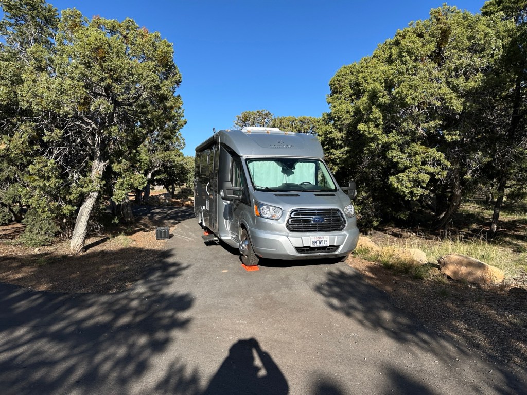
So this trip, we decided to make it a two day trip and actually it worked out really well. First night. We went over the Donner Pass and down the 93 to Beatty stayed the night and then on to the Grand Canyon the next day arriving in Williams for lunch at our favorite tacos Place
This trip was truly a Grand Canyon vacation. We drove to the Grand Canyon stayed in, stayed in the Grand Canyon and drove home.
Trying to book campgrounds at the last minute at the Grand Canyon, as well as other famous national parks, prove to be quite challenging. Fortunately using website called Wanderinglabs.com, enabled us to score a last minute cancellation for three nights at Mather campground in the same location. I made a bunch of one day reservations at Trailer village. Total of 6 nights.
It was a real fun trip we cycled every day out to Hermits rest (6 days in a row). We hiked down to Cedar Ridge. We walked along whole crest trail from Bright Angel to Kaibab.
Weather was fantastic and the Memorial Day weekend wasn’t too bad. Some photos with captions below.
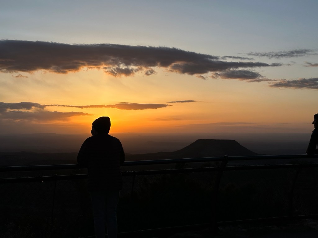
Vista while cyclingMather CampsiteKaibab trail headOoh Aah PointDown Kaibab trailTrailer VillageSunriseAt Cedar RidgeApres Hike/Bike
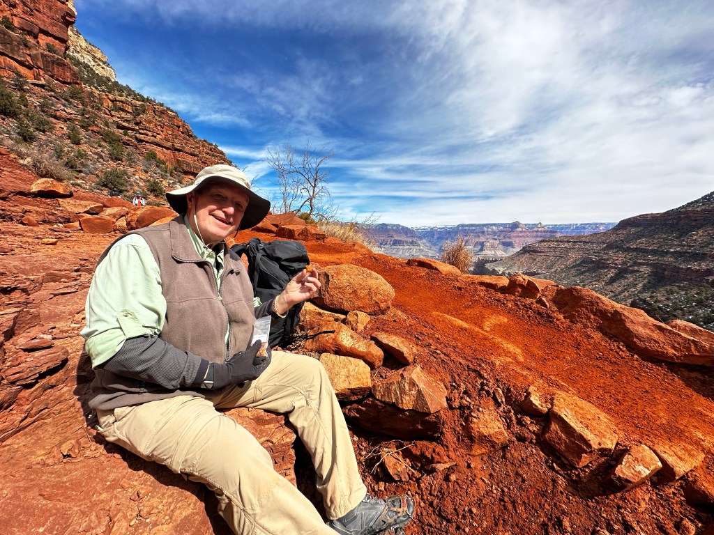
We begin our last day of 4 with a “hearty” 🙄 breakfast and coffee as we discussed our plans. Temp is about 37 degrees. Temp at the rim is probably 25 but will rise to 45 or so by the time we arrive 5.5 hours later. Be sure to click on the scenic photos below, to expand and enjoy.
Chow timeHearty breakfastFabulous barista
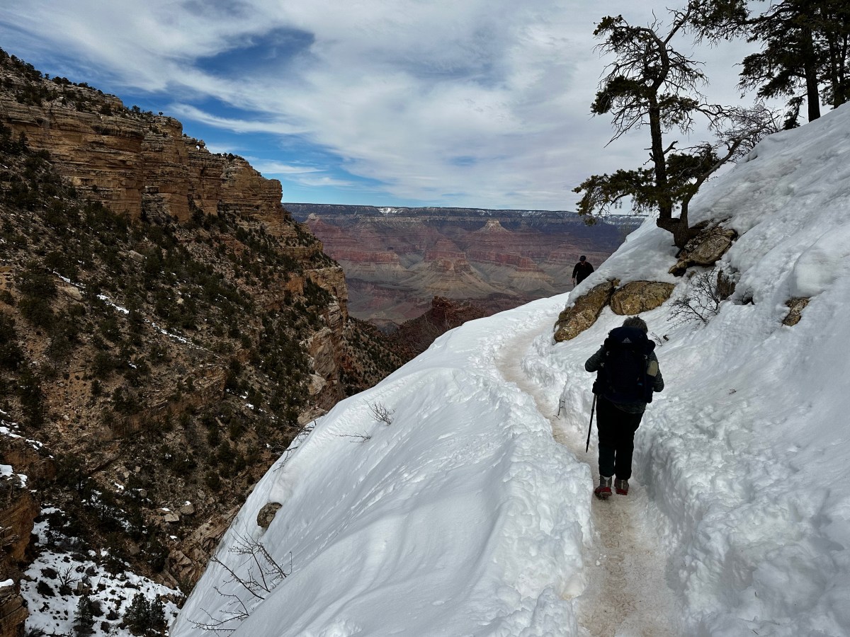
We break camp and pack up trying to get an early start on the 4 mile 3000 ft switchback hike pretty much straight up with snow the last 2.5 miles as you can see from the photo below. It appears daunting but doable.
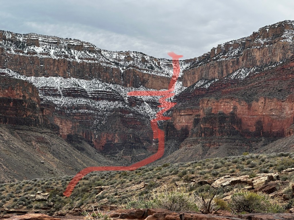
Here is where we are going today.
A perennial stream, Garden Creek, cuts through Havasupai Gardens, which is great for soaking aching shins. But there’s an even more significant water source here—a pump house. (Photos below from the internet).
Pump houseExposed water pipe by trailShe is happy camperHad a little problem back in 2019 which shut down some the park facilities for a little while. (Photo from internet)
What is truly amazing is that this water travels thru a 16-mile pipeline from a natural spring about 3,500 feet below the North Rim, across the Colorado River and up to Havasupai Gardens. From there, it is pumped to the South Rim, without which there would be no water on the South Rim where a large portion of the 6 million who visited the park in flushed toilets, took showers and filled water bottles.
Looking back north and down toward the Havasupai gardens camp
A little side note: we were told of the 6 million visitors annually, 1 percent or 60,000 walk at least a little ways below the rim. Of that, only 10% or 6,000 hike to the bottom. Wow. Pretty rare company I guess.
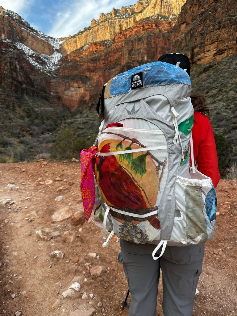
Turning around the other way. Looking up to our goalA fellow traveler who paints her backpack
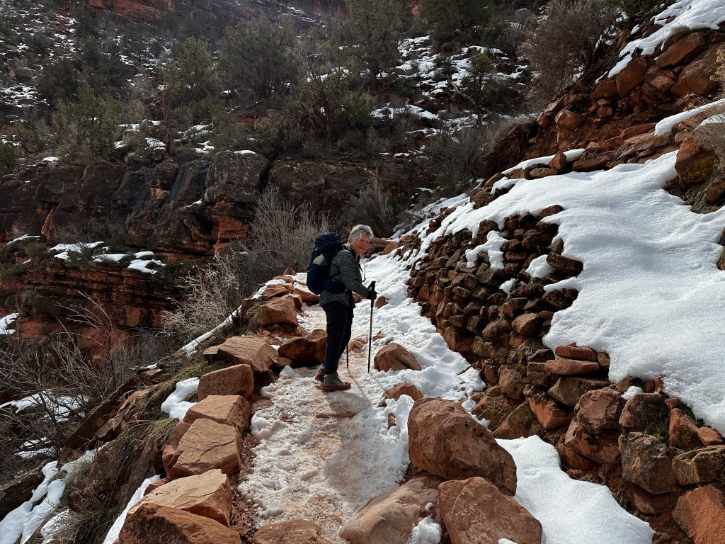
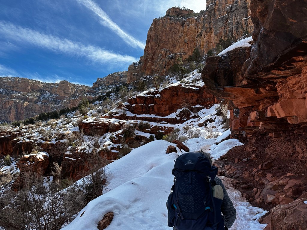
The first mile let us get warmed up for the switchbacks. Then the fun begins as much of the trail is shaded, a but muddy here and there AND, definitely icy. Some parts get sun but not much so we stopped in the one place for sun to take our major break. Glad we did.
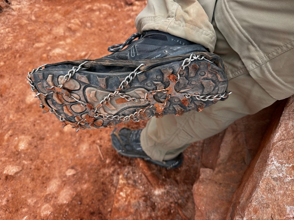
Icy trail last 2.5 milesOur snap on crampons or cleatsTaking a break in the sunBreak time
Up the switchbacks we go. Not a lot to tell here. Huff Puff! The photos do the speaking.
Up we goThe longest easiest part of the switchbacksTunnel 2. Still about 2 miles to goAnd on and on.
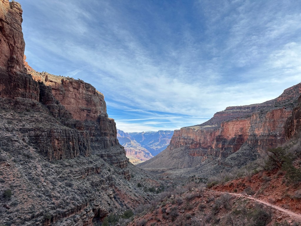
I stopped several times to look around and take a snapshot of the view of the deep canyons
Looking back norththe trailBright Angel Canyon far away.
Eventually we made it,but didn’t get a photo right at the top of the trailhead right near Kolb Studios. We celebrated, then headed directly to the shuttle bus station, ready for a shower back at the the van….which we hoped survived the cold during our trek and it did so admirably. We had left the electric heater turned on low, the Truma water heater on Eco (42 degrees) and it survived the 25 degree nights with 40 degree days. YAY!
Relief at the shuttle bus stop awaiting our chariot to the shower.
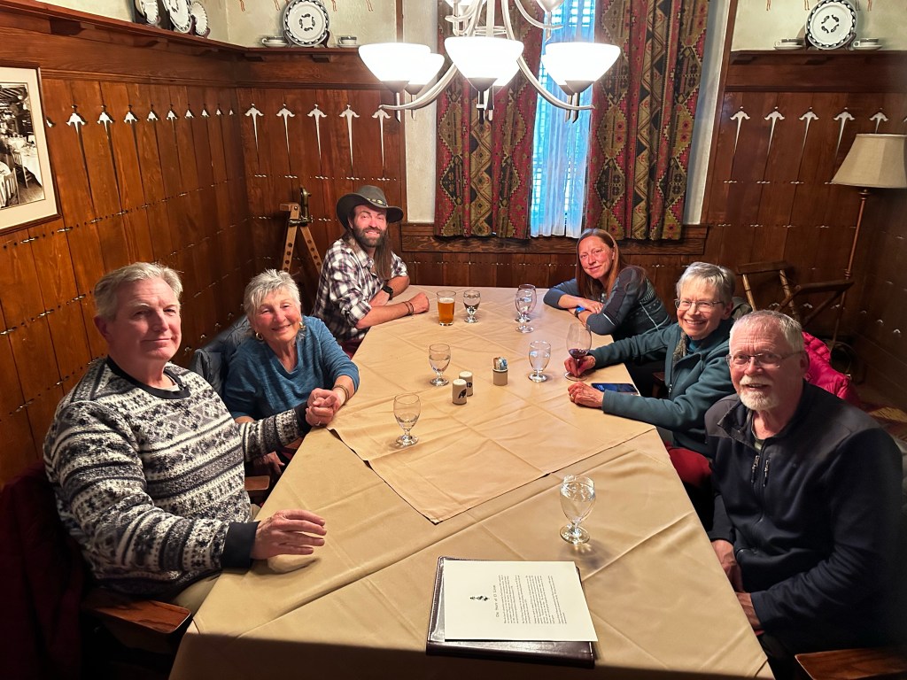
We did it!!! Not bad for a couple old farts approaching mid-70’s who hadn’t backpacked for almost 40 years. About 25 miles total in 4 days. 5000 feet down and 5000 feet up. 3 nights in a very small tent (ask us about it 🤣). We were ready to celebrate with a good meal at El Tovar Lodge with our companions. I will do a postmortem in a day or so for those interested. Suffice it to say we are glad we did it and tent camping is probably not in our future. All in all it was amazing and satisfying. Over a week later, we are still in recovery.
Our group. from the left, Kent, Sraddha, Kendrick, Mandy, Jan, Dave. The Crème Brûlée already disposed of.
We want to thank our guides, Mandy and Kendrick for their patience, understanding, expertise and support along this journey. We couldn’t and wouldn’t have done it without you. Their website is https://www.mandyleaphoto.com/
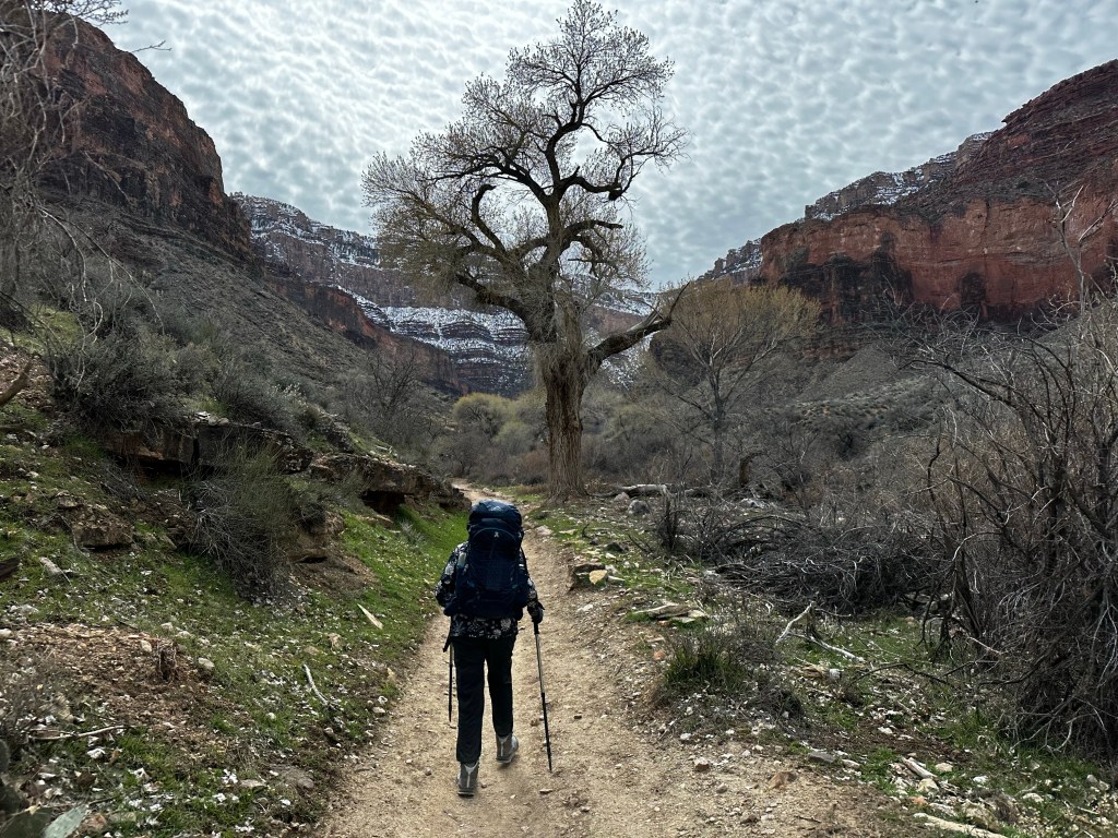
Today we hike 4.5 miles ascending 1,400 feet up to the Havasupai Gardens (formerly called Indian Gardens) Campground. For the first mile or so, from the Bright Angel Campground to the traverses exposed sand dunes, then across the silver bridge across the Colorado River, and west through more sand dunes to the Pipe Creek/River Resthouse area. The pipe under this bridge carries all the water supporting the south rim.
Hiking to the BridgeSilver Bridge Downriver from the Silver Bridge Which way?
More sand dunes keep us busy for another mile on south side of river with various examples of the Vishnu Schist, the oldest formation in the canyon at 1.8 billion years. Talk about ancient.
Along the riverVishnu SchistWe go that wayAlong the Sandy trail
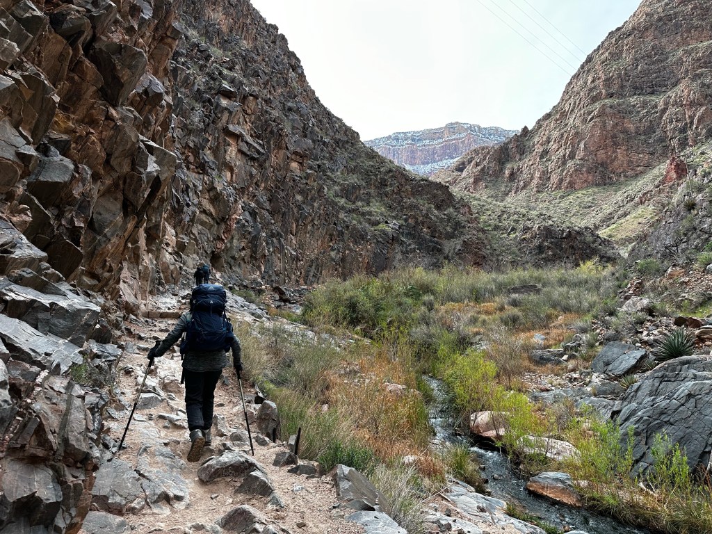
From the Pipe Creek resthouse, the trail turns south following a creek through a meandering gully of water-sculpted stone and shimmering cottonwood trees.
Pipe creek rest houseLower trail along Pipe CreekView of south rim in distance Several water crossings
From the NPS website: “While the South Kaibab Trail follows a ridge line, the Bright Angel Trail conforms to a fault, keeping to the back of the canyon during the first few miles. Views on the Bright Angel Trail are framed by massive cliffs, and by virtue of being a shadier trail with natural water sources, there is more plant life and animal life along the Bright Angel Trail than on the South Kaibab Trail. The majority of this trail’s elevation change takes place in the upper four miles of trail via a series of switchbacks that can seem endless.”
Up the Pipe creek drainageDevil’s Corkscrew from belowDevil’s Corkscrew from aboveAbove the Corkscrew at “Oh, Jesus!” Point
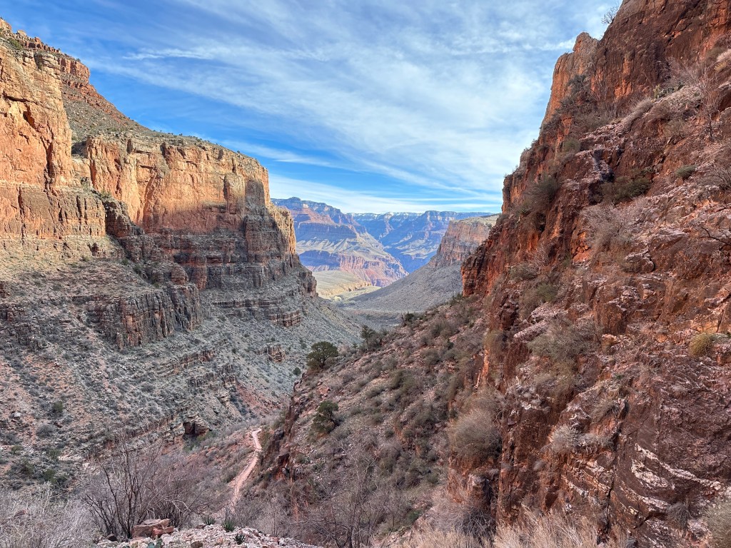
The trail becomes steep once again where this gully empties into the broad, bowl-shaped Pipe Creek drainage. This section of switchback trail, affectionately referred to as the Devil’s Corkscrew. And we could see why and I wouldn’t exactly say “affectionately” 😉
My view all dayAlong limestone cliffsLooking back towards north RimAlmost to camp
We continue up through some limestone following Garden Creek to the Havasupai Gardens Campground where we spent the night. Traditionally this was a key native American site where families lived and grew all kinds of vegetables and crops with the year round water. It is also the current location of a major NPS water pump station.
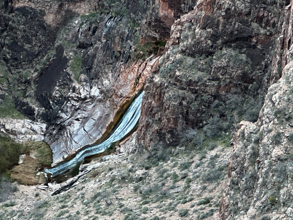
Hiking out to Plateau Point, me in the leadGarden Creek falls from Plateau PointProof of lifeLooking east towards Bright Angel trail below
After making camp, we headed out the 3.2 mile round trip “stroll” to Plateau Point, to view the river from a different perspective and eat our meager dinner in the wind. I had a surprisingly decent Phad Thai (as good as it can be when you just add hot water) We saw a California condor fly over. Condors are one of the nations best animal comeback stories. In 1982, there were only 22 California condors left in the world.
South rim. The highest point on left is Yavapai Geology Museum. We go up that canyon tomorrow.
Now there are about 400 Condors within the states. Returning after dusk, using headlamps, we gazed up at the lights of the Yavapai Geology Museum 3,000 above. Time to turn in, and rest for the final day tomorrow of 3,034ft climb in 4.5 miles.
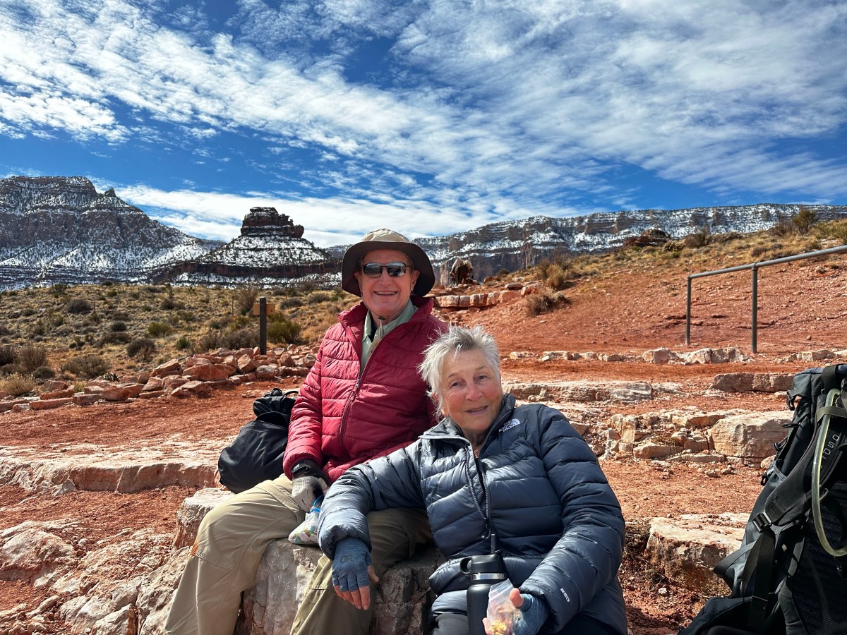
We spent 4 days hiking into and out of the Grand Canyon with 4 other people. 2 guides, Mandy Lea and Kendrick, and 2 wonderful people, Jan and David, from Minnesota. It was the first time our guides and taken a whole group of folks over 70 years of age! Each day will have its own flavor and blog post.
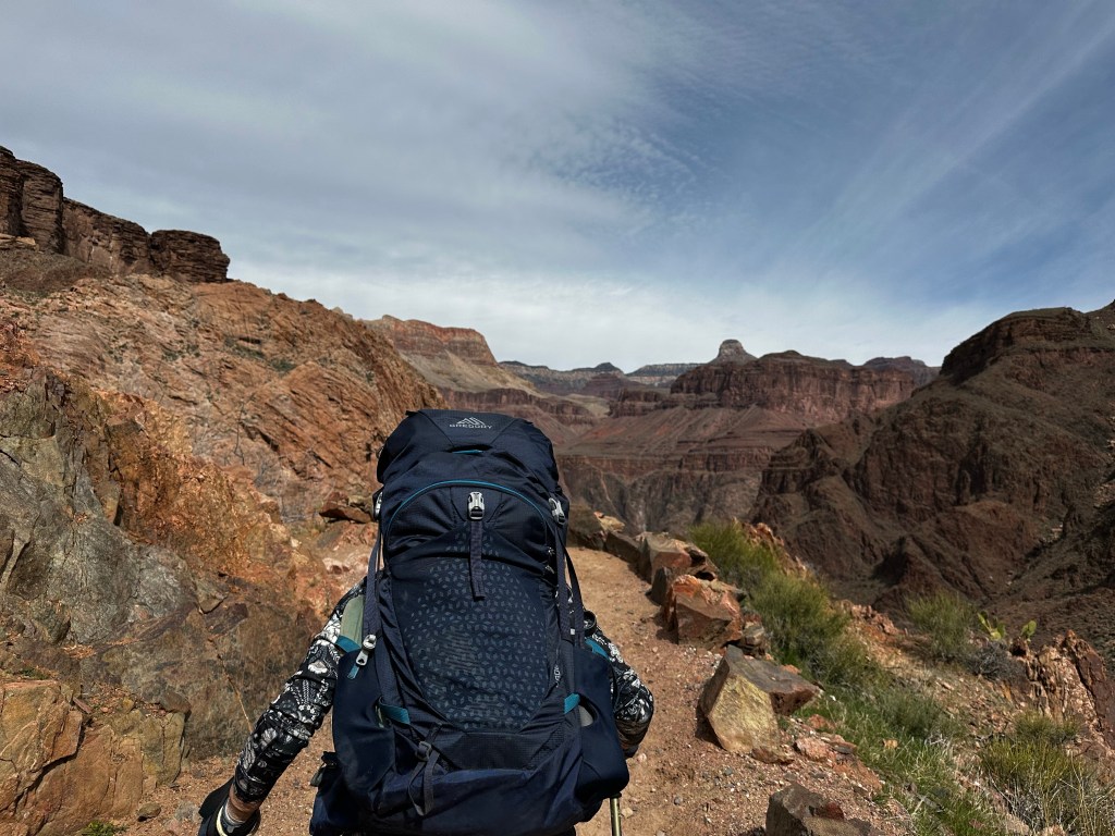
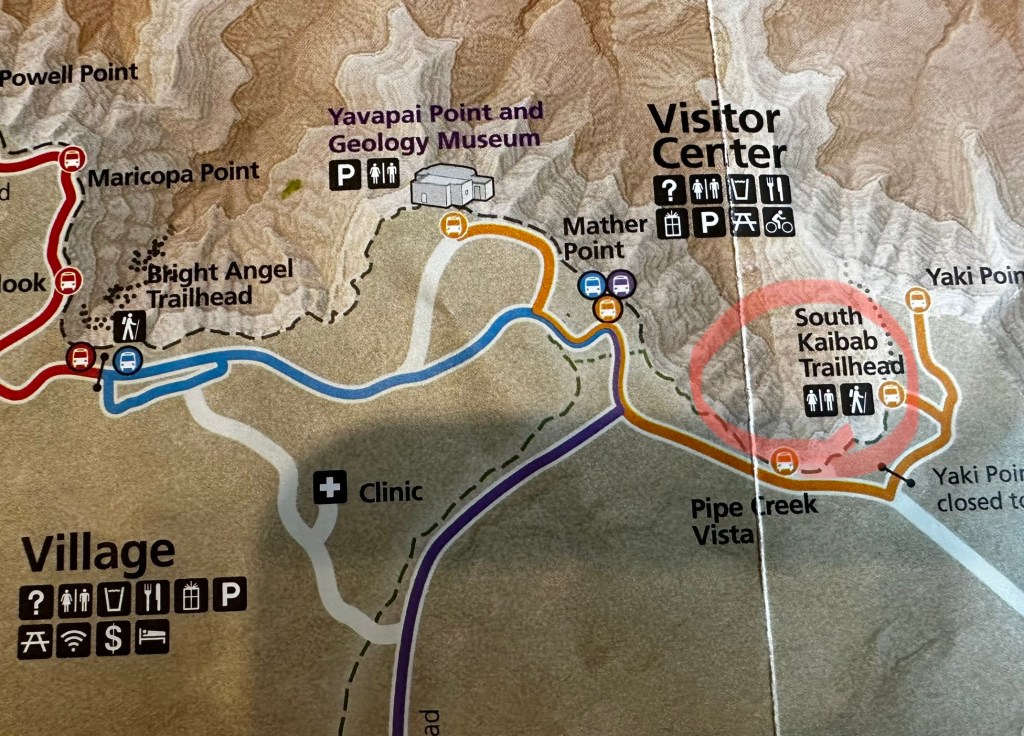
South Kaibab Trail begins near Yaki point just a mile or so east of the visitors center. We camped at Trailer village with hookups to ensure heat in our van while on the hike, since the south rim temps were forecasted to be from 22-39 F. A big snow storm has blanketed the rim the prior week.
NOTE: this is a long post.At least look at photos. Click on them to expand.
Backcountry info center and trailer village west of Visitor Center.South Kaibab trailhead east of Visitor Center
We took the blue line shuttle from camp at 6 AM to meet our group at the Backcountry Info Center on the west end of village. Grabbing a coffee at nearby Maswik Lodge, we board, at 7AM, the “Hiker Express” shuttle directly to Kaibab trailhead on the east end. See maps above with red circled areas.
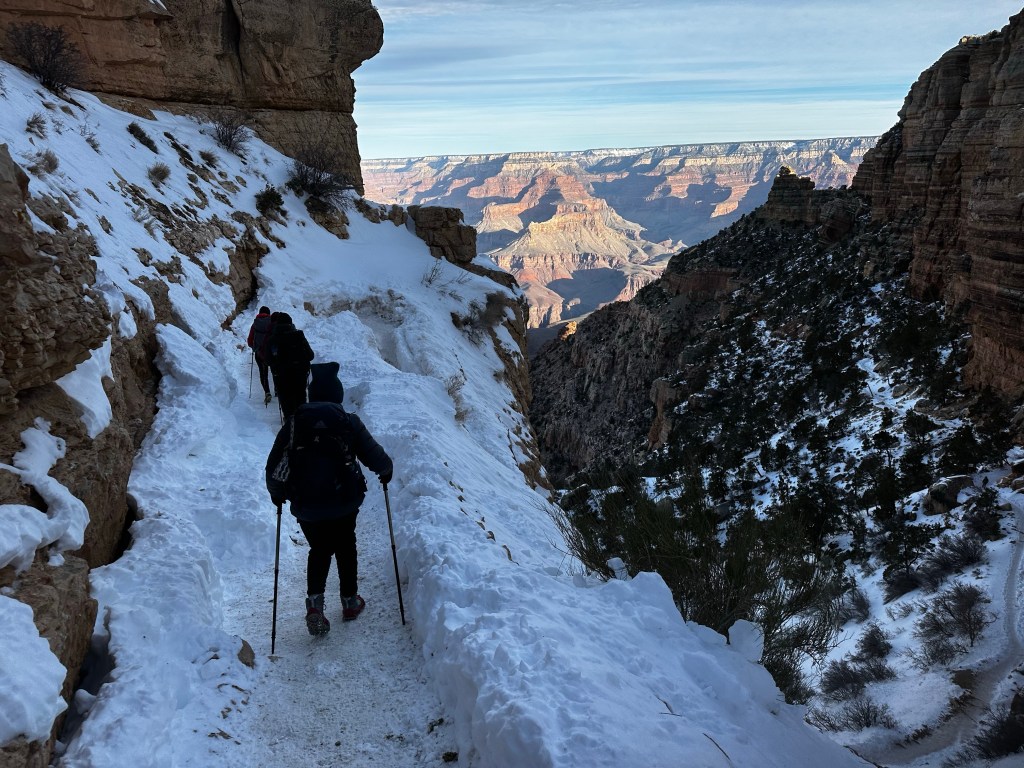
Trailhead with series of steep north facing switchbacks. First 2.5 miles ice and snow and mud. We had microspikes
A sense of anticipation was building. We had hiked the first mile or so down to Ooh Aah point last fall and before during dry season, but ice and snow is a different cat on a steep downhill trail. Dangerous and slippery, we tried to stick to the uphill side of the trail.
South Kaibab route map
Knowing there was snow/ice we were using Kahtoola micro-spikes which slip over our boots and provide stability down the series of steep north facing switchbacks to Ooh-Aah point and on down 1.5 miles to Cedar Ridge where we rested. Below this was mud, ice and mud-ice or “mice” in which we slipped a bit. Ask me about it. Needless to say we should left spikes on for another half mile. We continued down a good trail (except for the mud) to Skeleton Point, about 2.7 miles and 2,027 ft below the rim.
MudMud-iceSkeleton point
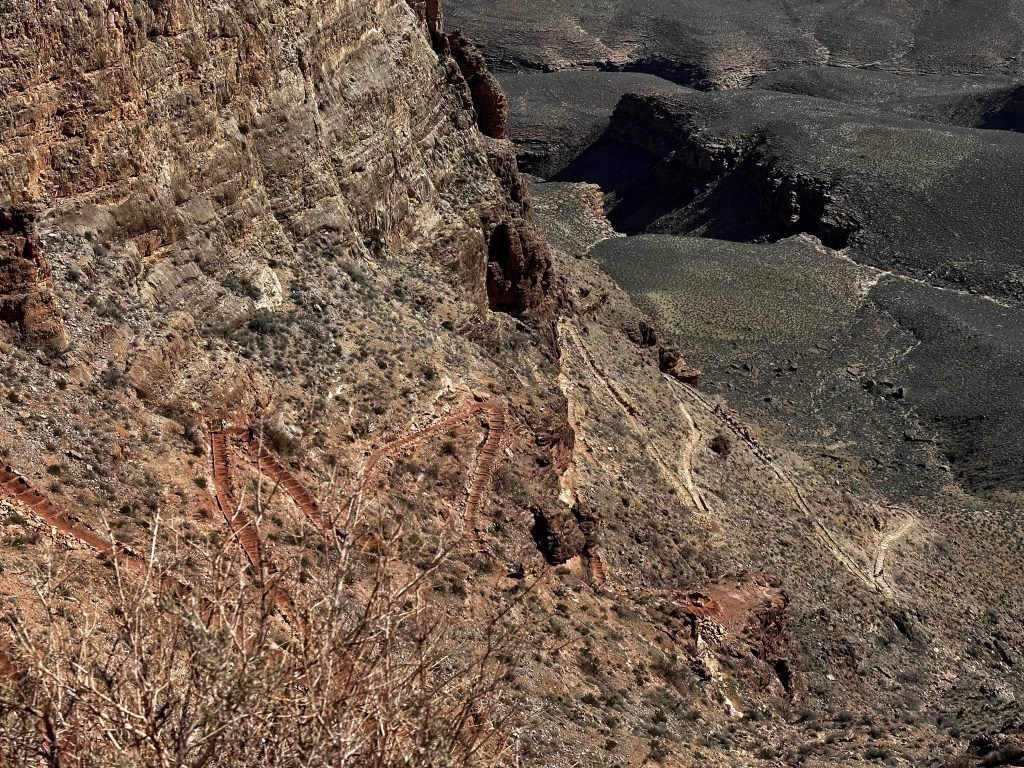
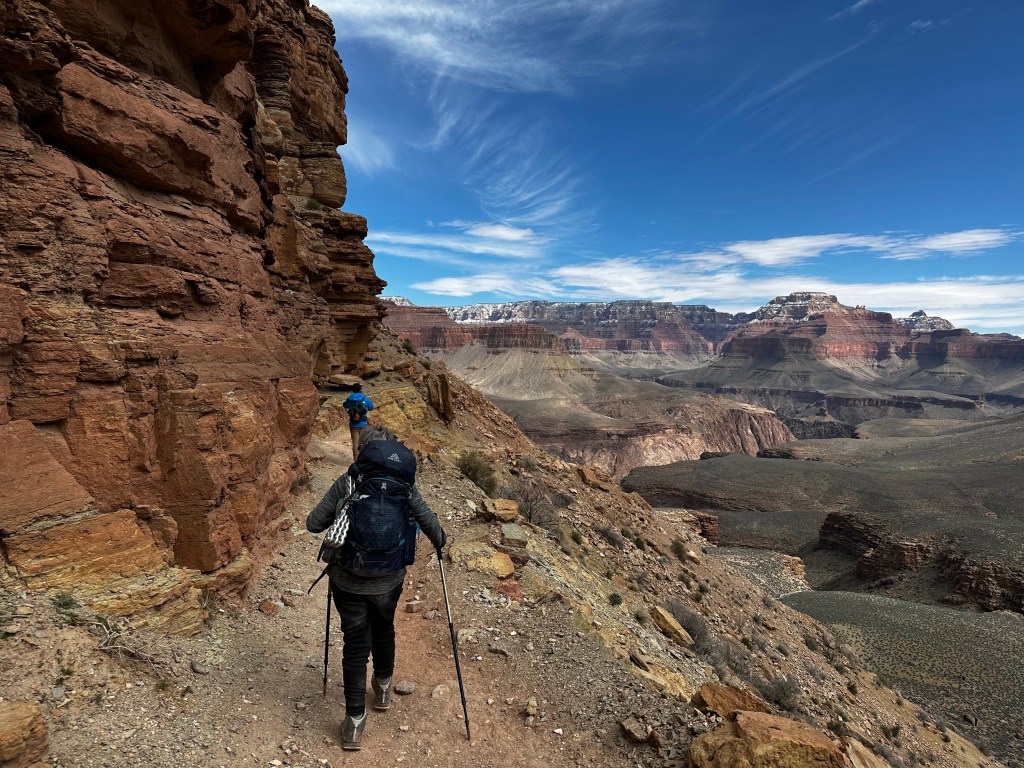
The next leg was down a very steep, rugged switchback called the “Red & White’s”on a trail blasted out of limestone cliffs, down to the Tonto Plateau. 4.5 miles and 3,200 ft below the rim. It’s called the “Red & Whites” because the limestone is white, however it is tinted red from all the other minerals and rocks around it. It was challenging but we made it down safely.
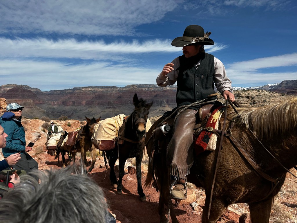
We are going down there?Red & White’s Switchbacks.NPS daily mule train
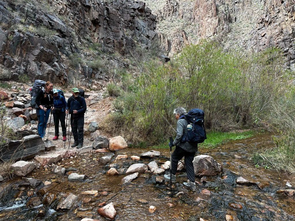
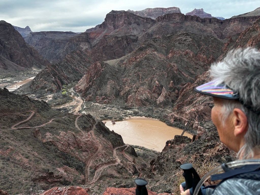
The Tonto plateau runs through the park on both sides of the Colorado river about 3000 feet below the rim and about 2000 feet above the river. We stopped for a rest at the “TipOff”. Which is a junction spot for the So. Kaibab and the Tonto Rim trails. A composting toilet Bathroom break helped, and we removed shoes to check the hot spots on feet. We refreshed the moleskin, dried out socks and headed on down.
Around that limestone bluff we just hiked downYep. Still some mud hereThe Tip Off and gorge beyond.
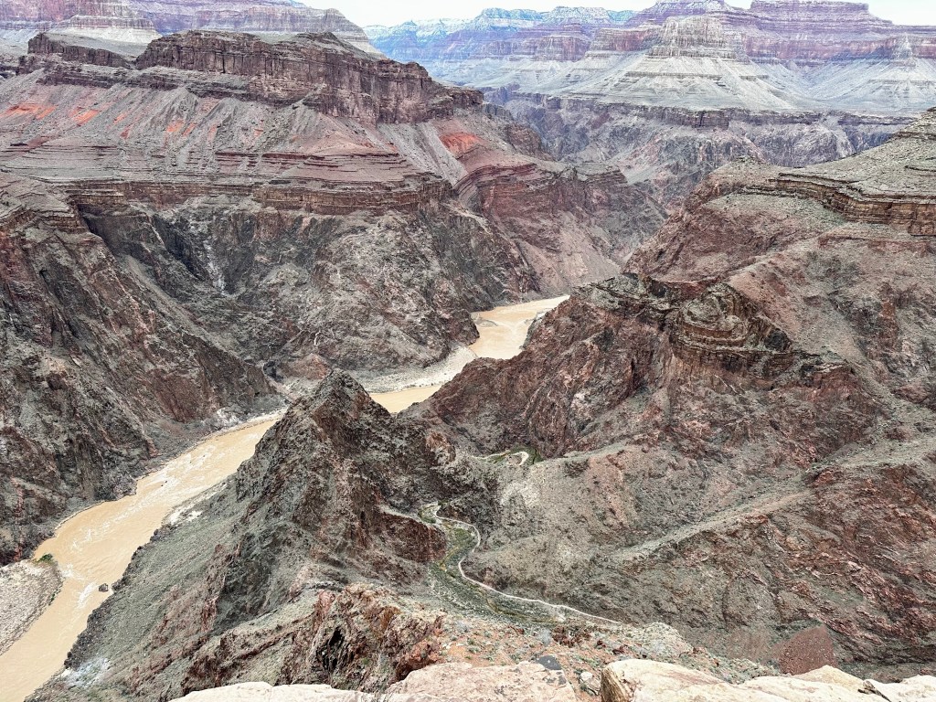
On the trail over 5+ hours now, we “tip off” into the gorge down switchbacks and really fun areas. Trail is in good shape. we snack during the down-hike. Me on clif bars, Gu, peanut M&M’s. Sraddha has Kind bars and Gu. We each have 3 liters of water and electrolytes for the 7.2 mile, 4,872 ft elevation drop. There is no water on the trail. My pack weighs 29 lb. Sraddha’s is 19-20.
Our guides, Mandy Lea and Kendrick have about 30 trips into the canyon. Experience has taught them to take care of the details and one of these details is to send down gear as much gear as possible with the mules, which included our sleeping bags and food etc went down earlier and awaited us at Phantom Ranch. This makes such a large difference Mandy led the other 2 people, Jan and David who are faster while Kendrick stayed with us
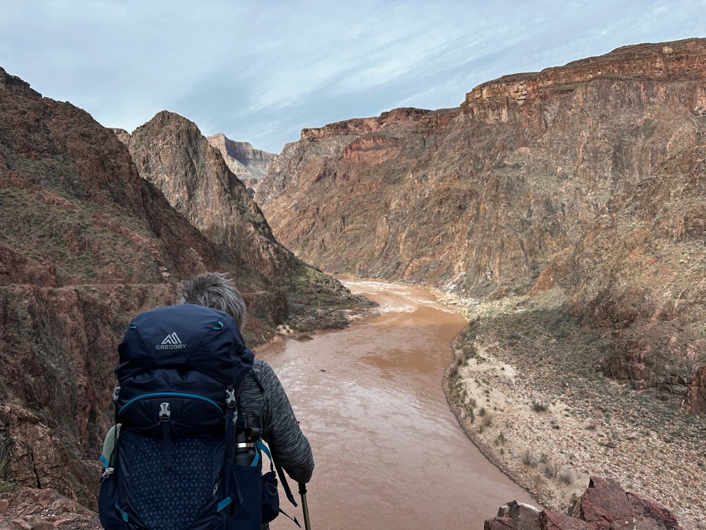
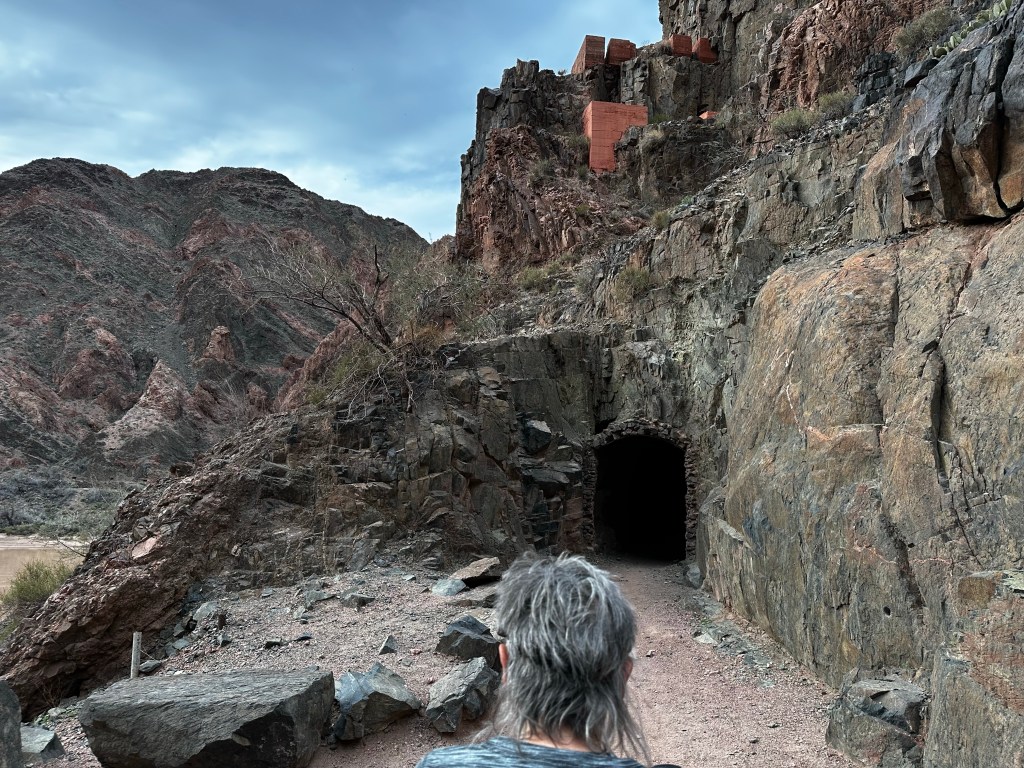
Below the Tonto plateauLooking down the switchbacks and the river. You can see the beach and the canyon up which is Phantom Ranch. 2.5 miles to goTunnel just before Kaibab Suspension Bridge
I didn’t take a lot of photos on the last leg as we were tiring. We made it thru the tunnel, across the suspension bridge and more or less trudged along the river, one…step…at…a…time. We were grateful, exhilarated and super glad we made it to the bottom before sunset. About 9 hours, 7.2 miles, 20,000 steps and 4,872 feet below the rim.
Soon to be sunset on Colorado River. The tents are for a conservation corps crew working on the trail. Not a great photo due to sun in distance creating shadows but, well you get the idea.
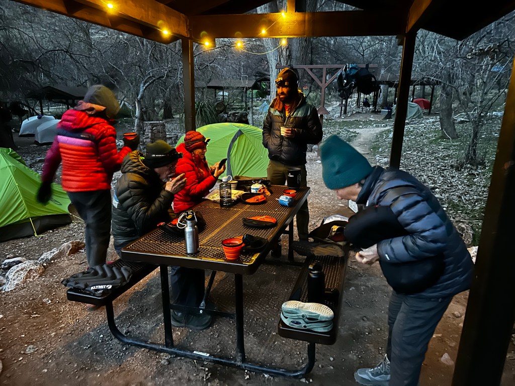
We camped at the Bright Angel Campground right near the confluence of the Bright Angel creek descending from the north rim and the Colorado river. Phantom Ranch itself is about 1/3 mile up the creek from the river. (so-to-speak). More about that later. We set up camp and ate, grateful we made it safely and more or less sanely.
Campsite at Bright Angel Campground. Dinner, just add hot water, stir and wait and wait and wait. The “Spork”, a combination for fork and spoon. Long version to dip down into and stir dinner
Daytime temp in mid 60’s and night time the low-mid 40’s. Most importantly the whole hike was in dry weather. I can’t stress enough how much this made our trip enjoyable. The previous week’s trip, our guides tell us, was colder, and much wetter. That’s a story for another day. Let’s just say we felt blessed.
Hopefully, i can find the time to make a shorter post about day 2 tomorrow. If you reached this “low point” 🙄. I urge you to subscribe to future posts on my home page and also leave any comments or questions. I will respond. I am not a big social media person, but it helps to know people read this.
We have been here so many times and keep returning.
This February has been a bit more chilly than previous years, however with Mighty Wonder Van, we have remained warm and cozy when needed.
In previous RV travels with our bigger Class A rig, we tended to live from the inside out.
Last year out teardrop trailer experience taught is the value of nimble living from the outside in.
Now, we have, what we consider the best of both worlds. We have nimble easy travel yet can tuck in when weather necessitates.
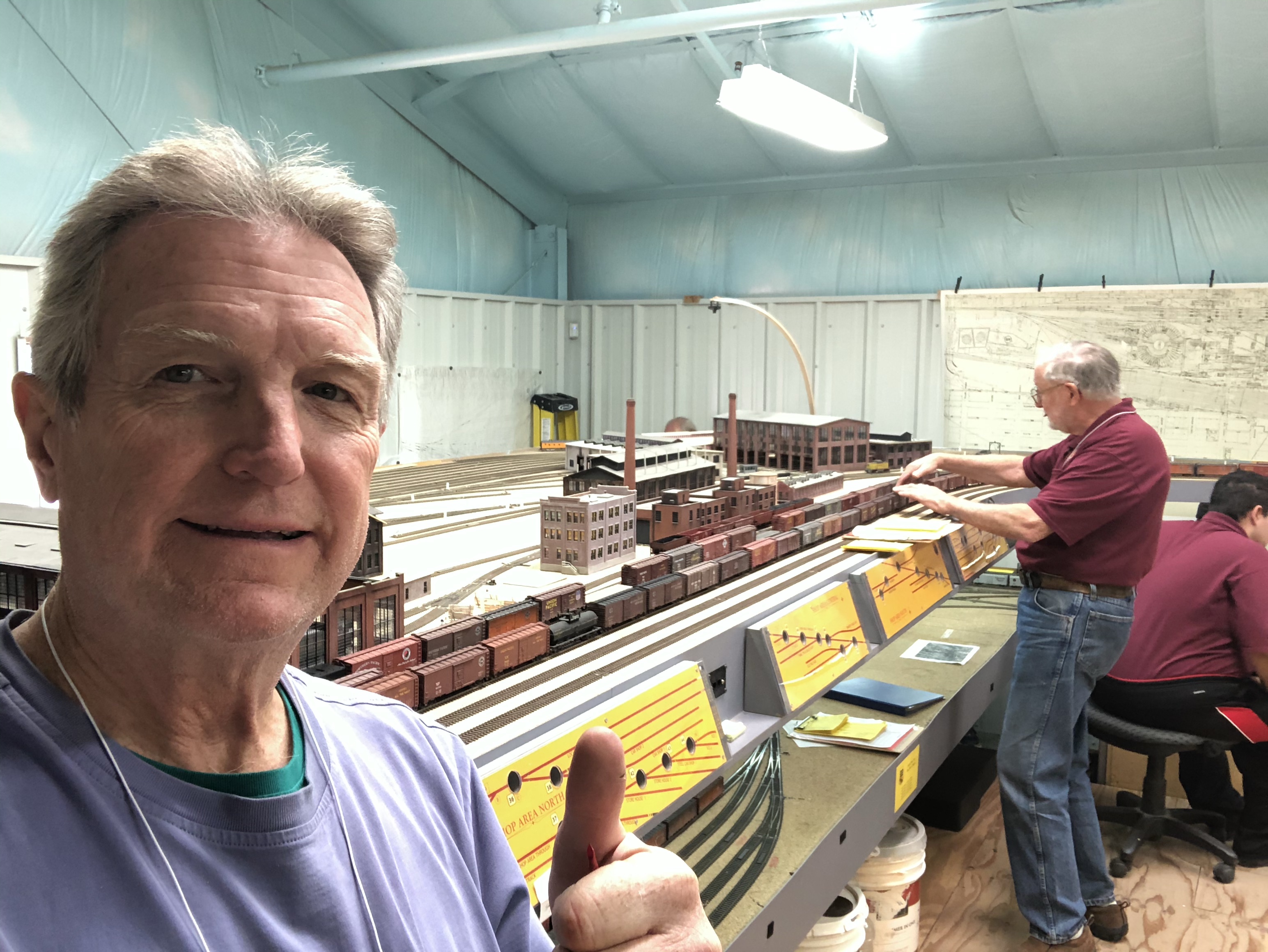
Early Feb saw me riddling icy roads to head over Donner pass to take a shorter route thru western Nevada to Sedona AZ for a model Railroad meetup with some buddies.
Not totally about birds and grasslands but mostly. Saturday evening I feasted on a pizza at the Velvet Elvis here in Patagonia while Sraddha stayed back home resting and relaxing. Met a delightful couple who used to live in Tucson and were touring the area after his business meetings. Turns out a lot of tourists, birders, etc love to travel through here in winter time (big surprise) and also in summer because it is cooler in higher elevations of over 4,000 to 5,0000 ft.
We had a wonderful afternoon at Paton's Bird yard then awoke to gusty winds on Sunday morning. Sraddha went over to the Nature conservancy while I nursed a sore foot from our recent power walks. Getting old in body with a few of the usual aches and pains but we tend to pay more attention to them these days since the body doesn't heal as fast as it used to. My right shoulder as case in point. I had messed up the tendons last summer during our big move out of the house and it is still hurting on a daily basis. I have had the cortisone shots which have helped but cannot work out regularly to this day and when I lift arm weights, it is half as much on the right side as left. Dr. Peter says the “tincture of time” will help and it has but I still guard against further injury and favor my left side. Now a sore right foot. But enough of my whining.
I had heard that the hawks fly in the mornings up in the hills south of town so we decided to head up the road in search of them.
beautiful Sycamore tree up Harshaw road
Oops. Gas guage nearly empty. Not the right time to venture out in to unknown hills. Where to get some gas? We had explored gas at the Arivaca market but it was $0.40 more than Tucson so we figured we would wait. When we drove through Nogales area we didn't see a convenient station to fill up while towing. We had anticipated fueling up in Patagonia.
Looking north towards San Canelo Pass. Sonoita beyond.
Those of you who live in the rural areas can relate when I say the only gas station in town is closed on Sundays! And they were surprisingly more expensive than Arivaca!
Panorama of San Rafael Valley Huachuca mountains in background (Southeast) Mexico on right horizon
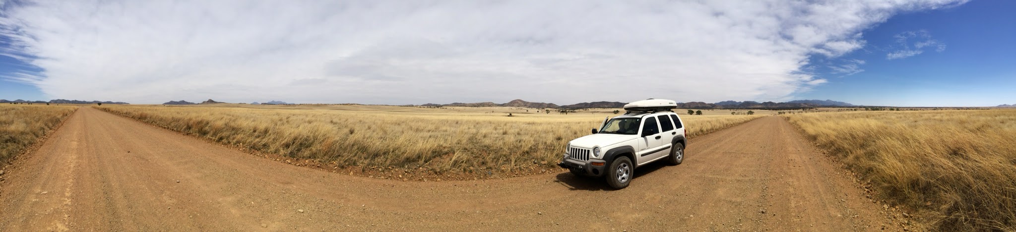
So off east 12 miles to Sonoita we go to find the Shell station where the gas was more reasonable and, most important, available. We had originally planned a little 90 minute drive but this ended up 4 hours and we are happy we did it. We ventured south into the Coronado National Forest over a winding road from Sonoita about 25 miles to a dirt road which took us thorugh Juniper and Pinon Pine forests up over San Canelo Pass.
View south to San Rafael Valley and Mexico from San Canelo Pass (5300 ft elevation)
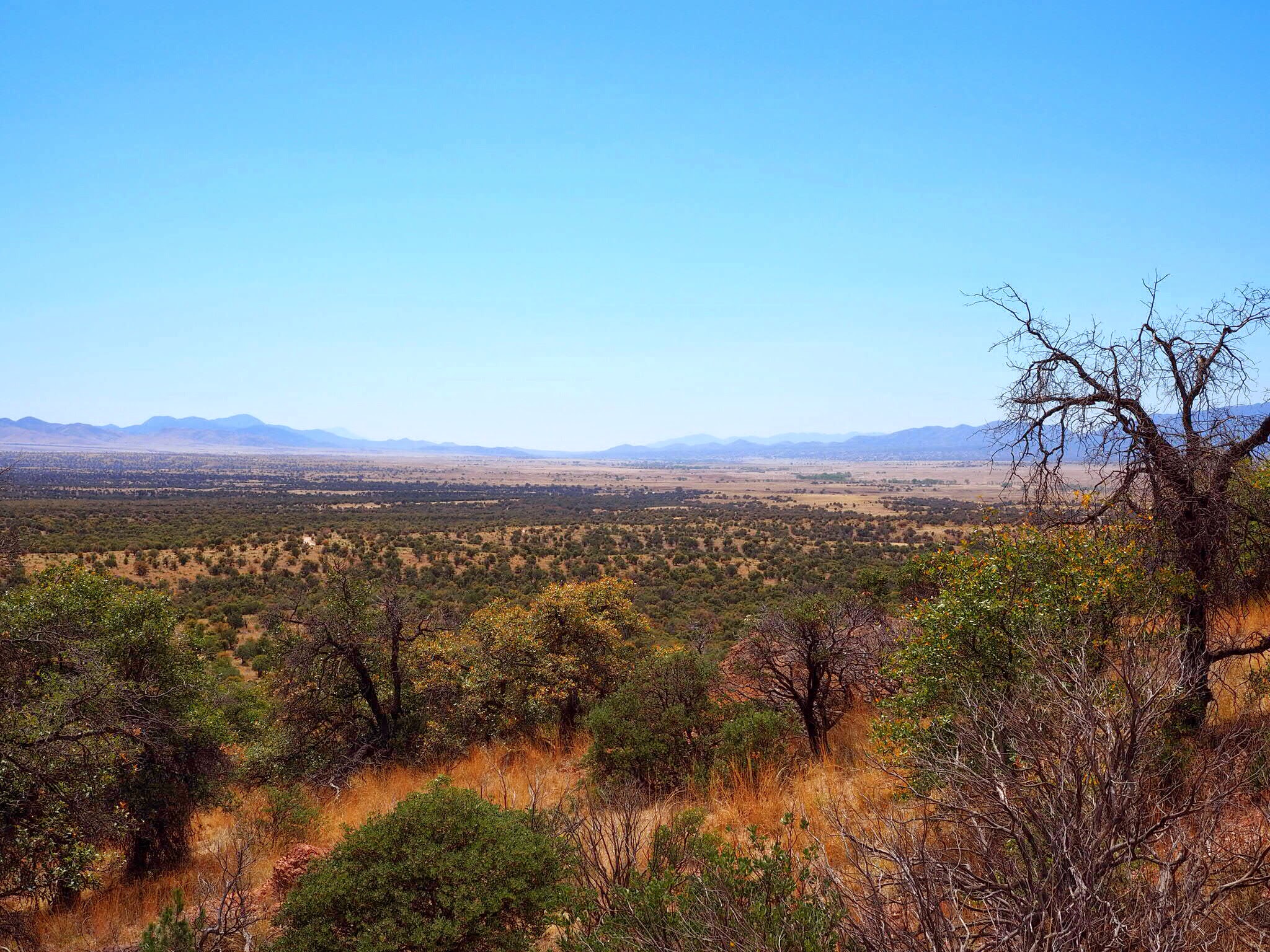
Down in to San Rafael Valley and some incredibly beautiful and sparse natural grasslands remeniscent of a bygone era when the whole of southern Arizona was grasslands prior to the cattle ranchers moving in. We saw some cattle spread all around the valley and several ranches who seem to be more conservation minded these days. Drought has hit this area harder than the rest of Arizona but wildfire has not so the grasslands remain in tact.
San Rafael Valley looking south to Mexico
As we descended into the valley we could see the radar station used by the border patrol for monitoring the area. We saw several border patrol trucks as we drove along. A few ranch trucks too. We saw 6 or 7 Kestrals hunting or resting so we knew there was food for them around the area. Evidence of deer and other animals were seen when we looked.
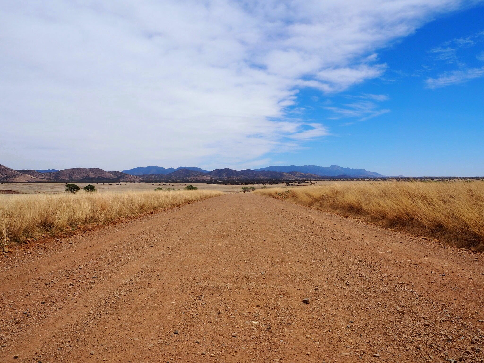
Long dirt road in pretty good shape.
Headed west again through Juniper and Pinon pine forests over to Mowry in the western border of the valley. Only thing there was some homesteads and mailboxes.
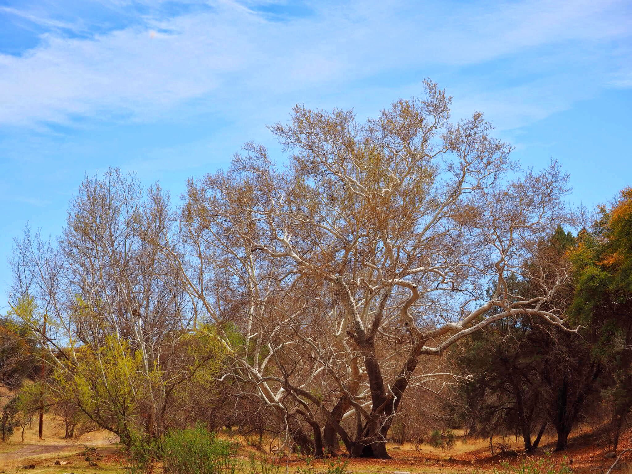
Harshaw - Adobe structure
As we descended through the canyons we happened onto Harshaw, an old ghost town with one adobe shack and a cemetary. Several families were visiting the cemetary to pay respects to their ancestors. We saw this amazing old Sycamore up the canyon. Sycamore trees line the canyons at this elevation (4000-5500) and are just beginning to bloom our. Amazing trees.
Old Sycamore tree in Harshaw
Continuing down the road we made it back to Patagonia for a late lunch then over to Paton's Bird Yard one more time.
We did see a couple red tail hawks but no Grey Hawks, or Zone tailed Hawks we had hoped to see. All in all it was a fun drive and we were glad we had to drive over to Sonoita for gas, otherwise we might not have seen this incredible valley.
31.540535 -110.740599
Tohono Chul in Tucson, Arizona, USA, has some pretty cool places to photograph. i shot this garden vase diagonally with water flowing all around it.