We are a few days removed from the hike and still feeling worn out. We are in Tucson area having moochdocked at our friends place, doing laundry and looking at photos. We moved over to the Tucson Mountain Park to commune with the cactus. Then over to Catalina State park, then over to our friends place in Oro Valley. We have absolutely no ambition to hike despite being in very good shape. No injuries. Just drained. Interesting. It’s like we floated on a sea of grace and hard work to make the hike down and back. And now feel a part of us was left in the canyon.
Tucson Mountain Park
Granted we are really ok just feeling like a couple slugbugs. Still in recovery tho.
Downtown Tucson
We are asked if we would do it again. Being in the canyon is magical. Being on the rim looking down is magical (if you spend some time doing so, not just 30 minutes of selfies).
Checking email
We loved being in the canyon. We loved the hiking. The tent camping not so much anymore.
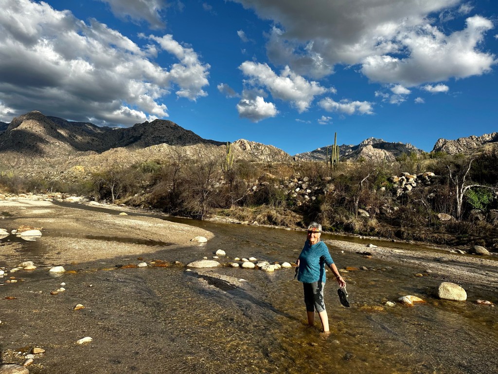
River crossing at Catalina State Park
We wouldn’t mind staying a few nights (minimum 3) at the Phantom Ranch to savor the area more deeply. However, practically, that presupposes a 1 day hike down and 1 day hike out. Is it doable? With some additional conditioning it would make it a little easier. With some planning, we could arrange for most items to be transported by mule both ways thereby only needing to carry water, essential first aid, and snacks for hike down and back. Will we?
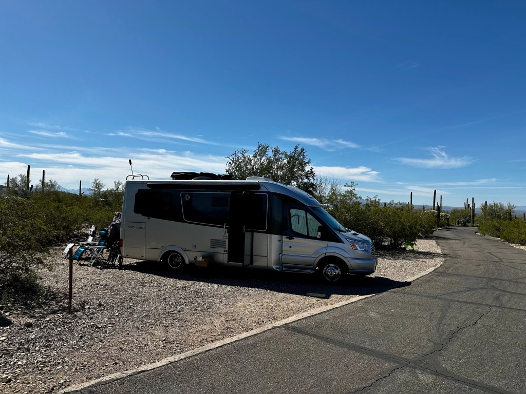
One of our favorite lunch spots in Tucson
The key here is planning and the phantom ranch lottery is chancy. Nevertheless we will take some time to recover and decide later if we wish to make an application for a permit and reservation.
Cheesecake anyone?
In the meantime, we will savor the experience, with gratitude, enjoy the memories and photos, laugh at our foibles and move on to what is next. Like visiting the Arizona Sonora Desert Museum. Desert or Dessert?
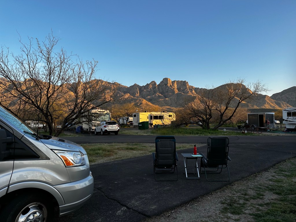
Relaxing at Catalina State park
We are doing a little walking and bike riding. Exploring. Running errands. And on to the next day, the next moment, the next adventure.
Out for a ride for a change.
The memories remain fresh. The images still return. Glad I took a bunch of photos. Would we love to return? Yes!. Will we? Um….TBD.
A reflective view from trip makes it hard not to want to.
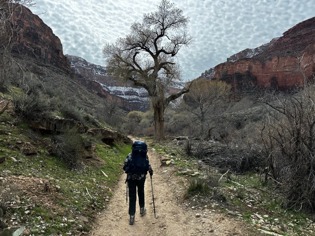
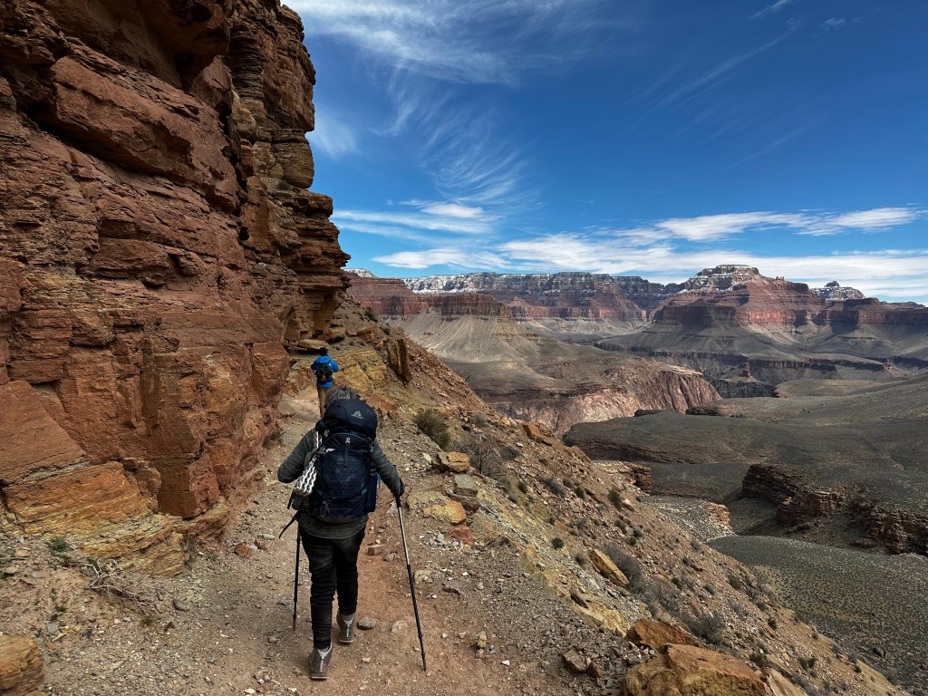
Today we hike 4.5 miles ascending 1,400 feet up to the Havasupai Gardens (formerly called Indian Gardens) Campground. For the first mile or so, from the Bright Angel Campground to the traverses exposed sand dunes, then across the silver bridge across the Colorado River, and west through more sand dunes to the Pipe Creek/River Resthouse area. The pipe under this bridge carries all the water supporting the south rim.
Hiking to the BridgeSilver Bridge Downriver from the Silver Bridge Which way?
More sand dunes keep us busy for another mile on south side of river with various examples of the Vishnu Schist, the oldest formation in the canyon at 1.8 billion years. Talk about ancient.
Along the riverVishnu SchistWe go that wayAlong the Sandy trail
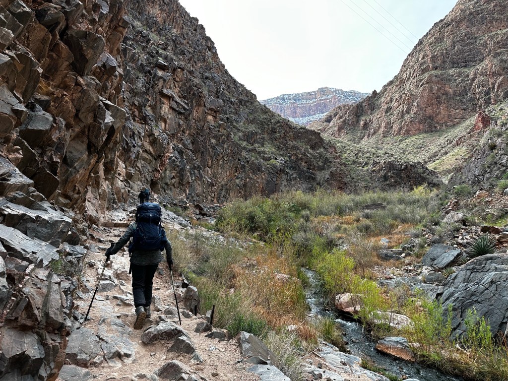
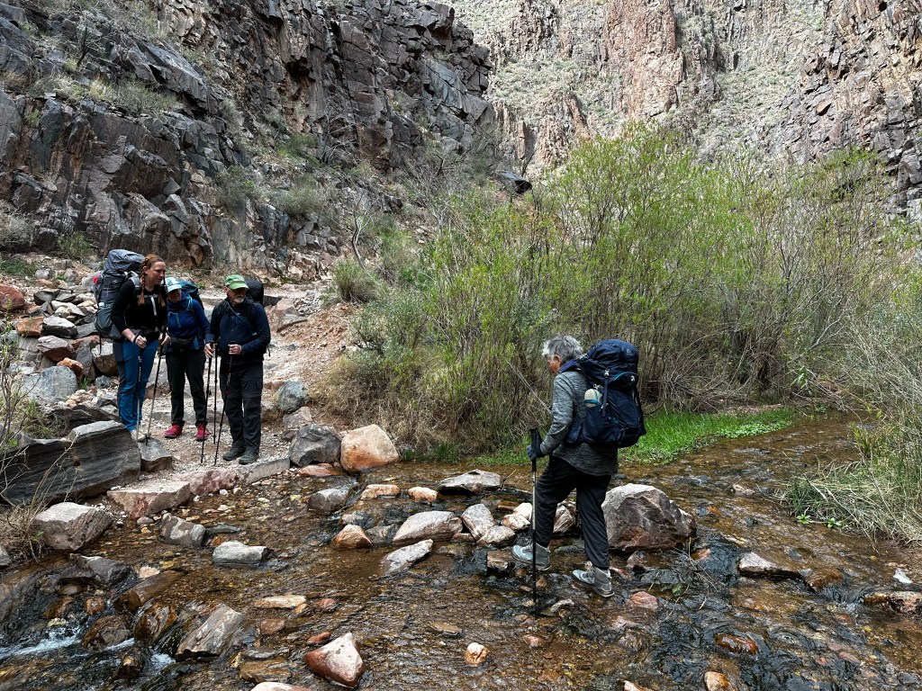
From the Pipe Creek resthouse, the trail turns south following a creek through a meandering gully of water-sculpted stone and shimmering cottonwood trees.
Pipe creek rest houseLower trail along Pipe CreekView of south rim in distance Several water crossings
From the NPS website: “While the South Kaibab Trail follows a ridge line, the Bright Angel Trail conforms to a fault, keeping to the back of the canyon during the first few miles. Views on the Bright Angel Trail are framed by massive cliffs, and by virtue of being a shadier trail with natural water sources, there is more plant life and animal life along the Bright Angel Trail than on the South Kaibab Trail. The majority of this trail’s elevation change takes place in the upper four miles of trail via a series of switchbacks that can seem endless.”
Up the Pipe creek drainageDevil’s Corkscrew from belowDevil’s Corkscrew from aboveAbove the Corkscrew at “Oh, Jesus!” Point
The trail becomes steep once again where this gully empties into the broad, bowl-shaped Pipe Creek drainage. This section of switchback trail, affectionately referred to as the Devil’s Corkscrew. And we could see why and I wouldn’t exactly say “affectionately” 😉
My view all dayAlong limestone cliffsLooking back towards north RimAlmost to camp
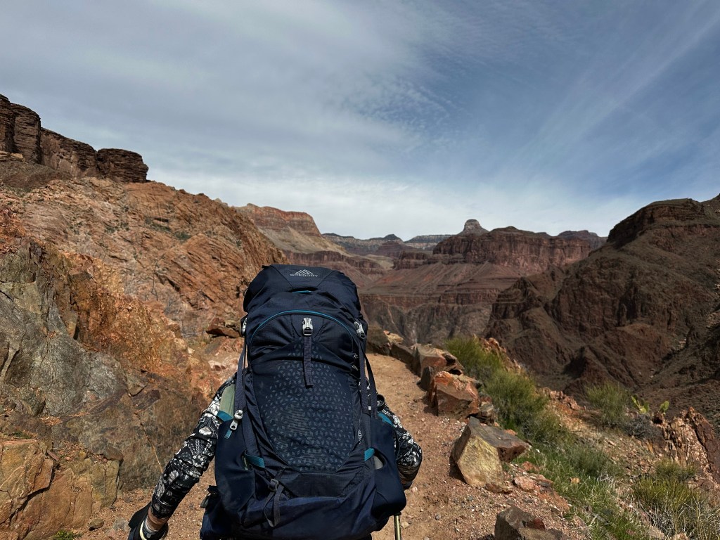
We continue up through some limestone following Garden Creek to the Havasupai Gardens Campground where we spent the night. Traditionally this was a key native American site where families lived and grew all kinds of vegetables and crops with the year round water. It is also the current location of a major NPS water pump station.
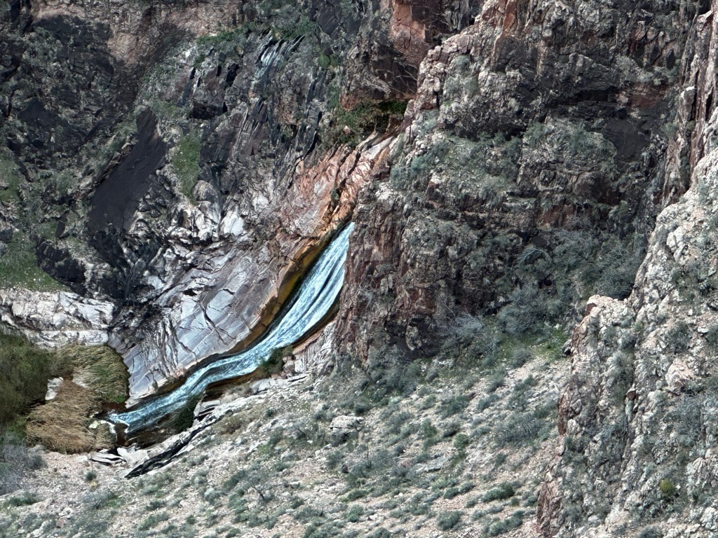
Hiking out to Plateau Point, me in the leadGarden Creek falls from Plateau PointProof of lifeLooking east towards Bright Angel trail below
After making camp, we headed out the 3.2 mile round trip “stroll” to Plateau Point, to view the river from a different perspective and eat our meager dinner in the wind. I had a surprisingly decent Phad Thai (as good as it can be when you just add hot water) We saw a California condor fly over. Condors are one of the nations best animal comeback stories. In 1982, there were only 22 California condors left in the world.
South rim. The highest point on left is Yavapai Geology Museum. We go up that canyon tomorrow.
Now there are about 400 Condors within the states. Returning after dusk, using headlamps, we gazed up at the lights of the Yavapai Geology Museum 3,000 above. Time to turn in, and rest for the final day tomorrow of 3,034ft climb in 4.5 miles.
We spent 4 days hiking into and out of the Grand Canyon with 4 other people. 2 guides, Mandy Lea and Kendrick, and 2 wonderful people, Jan and David, from Minnesota. It was the first time our guides and taken a whole group of folks over 70 years of age! Each day will have its own flavor and blog post.
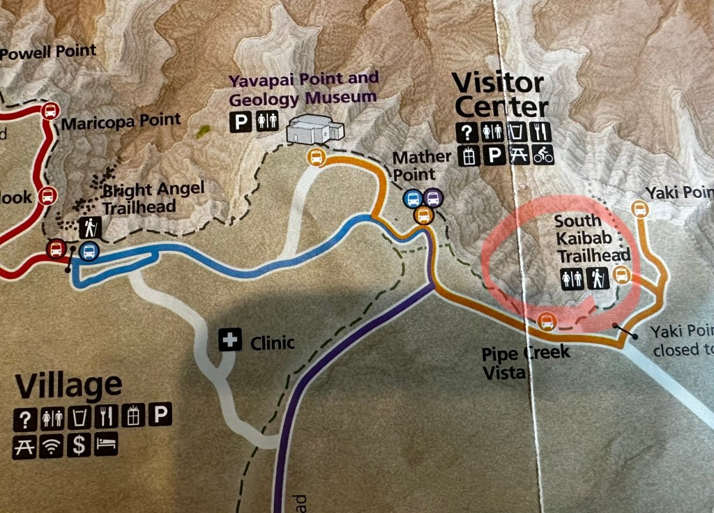
South Kaibab Trail begins near Yaki point just a mile or so east of the visitors center. We camped at Trailer village with hookups to ensure heat in our van while on the hike, since the south rim temps were forecasted to be from 22-39 F. A big snow storm has blanketed the rim the prior week.
NOTE: this is a long post.At least look at photos. Click on them to expand.
Backcountry info center and trailer village west of Visitor Center.South Kaibab trailhead east of Visitor Center
We took the blue line shuttle from camp at 6 AM to meet our group at the Backcountry Info Center on the west end of village. Grabbing a coffee at nearby Maswik Lodge, we board, at 7AM, the “Hiker Express” shuttle directly to Kaibab trailhead on the east end. See maps above with red circled areas.
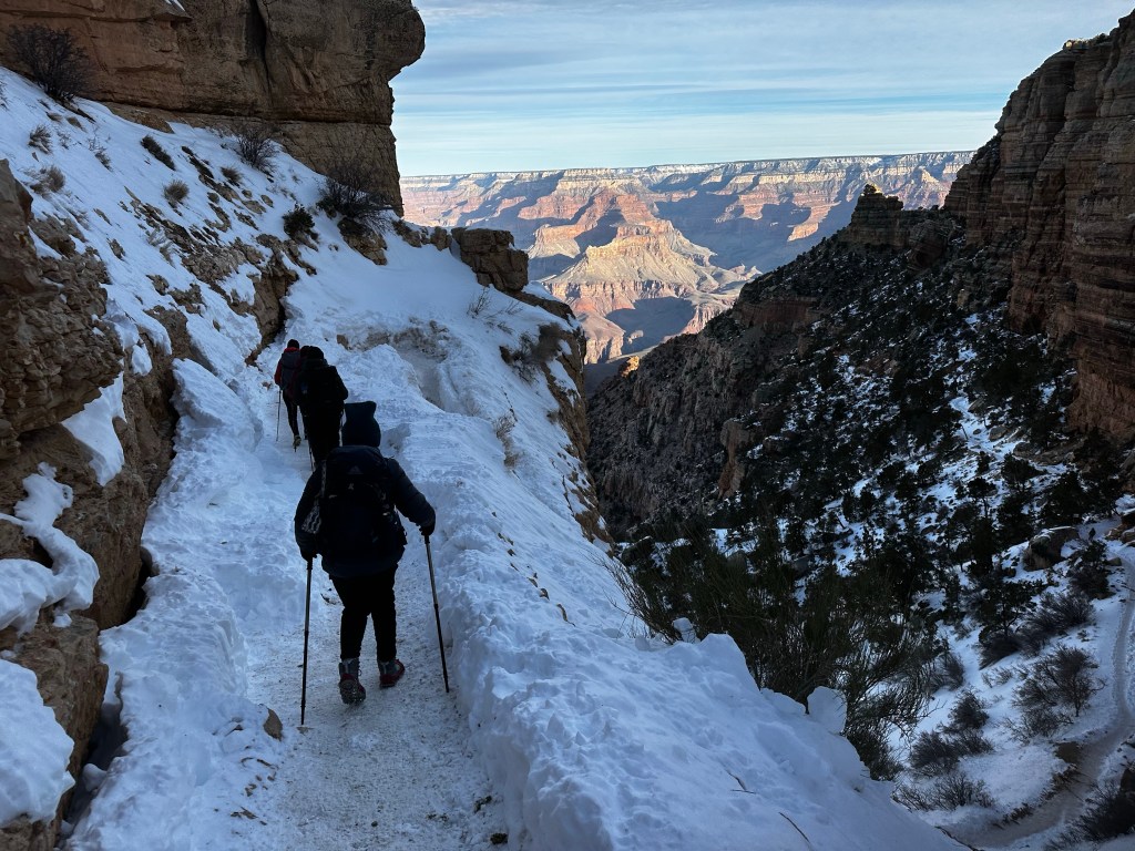
Trailhead with series of steep north facing switchbacks. First 2.5 miles ice and snow and mud. We had microspikes
A sense of anticipation was building. We had hiked the first mile or so down to Ooh Aah point last fall and before during dry season, but ice and snow is a different cat on a steep downhill trail. Dangerous and slippery, we tried to stick to the uphill side of the trail.
South Kaibab route map
Knowing there was snow/ice we were using Kahtoola micro-spikes which slip over our boots and provide stability down the series of steep north facing switchbacks to Ooh-Aah point and on down 1.5 miles to Cedar Ridge where we rested. Below this was mud, ice and mud-ice or “mice” in which we slipped a bit. Ask me about it. Needless to say we should left spikes on for another half mile. We continued down a good trail (except for the mud) to Skeleton Point, about 2.7 miles and 2,027 ft below the rim.
MudMud-iceSkeleton point
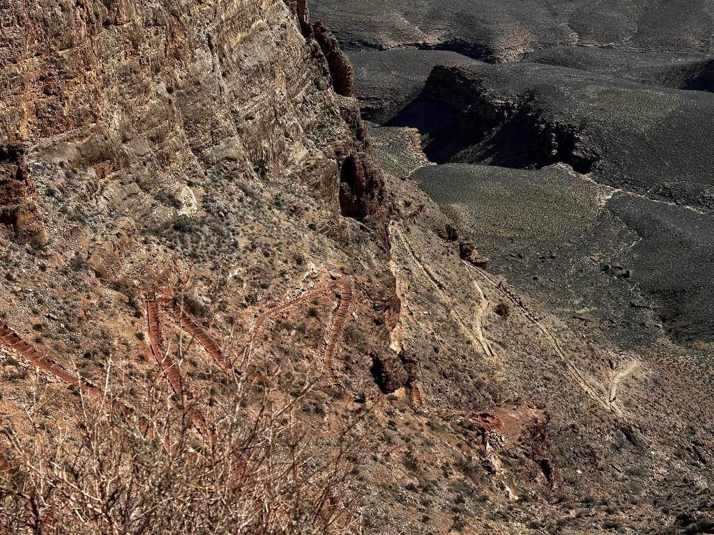
The next leg was down a very steep, rugged switchback called the “Red & White’s”on a trail blasted out of limestone cliffs, down to the Tonto Plateau. 4.5 miles and 3,200 ft below the rim. It’s called the “Red & Whites” because the limestone is white, however it is tinted red from all the other minerals and rocks around it. It was challenging but we made it down safely.
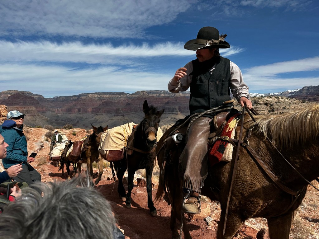
We are going down there?Red & White’s Switchbacks.NPS daily mule train
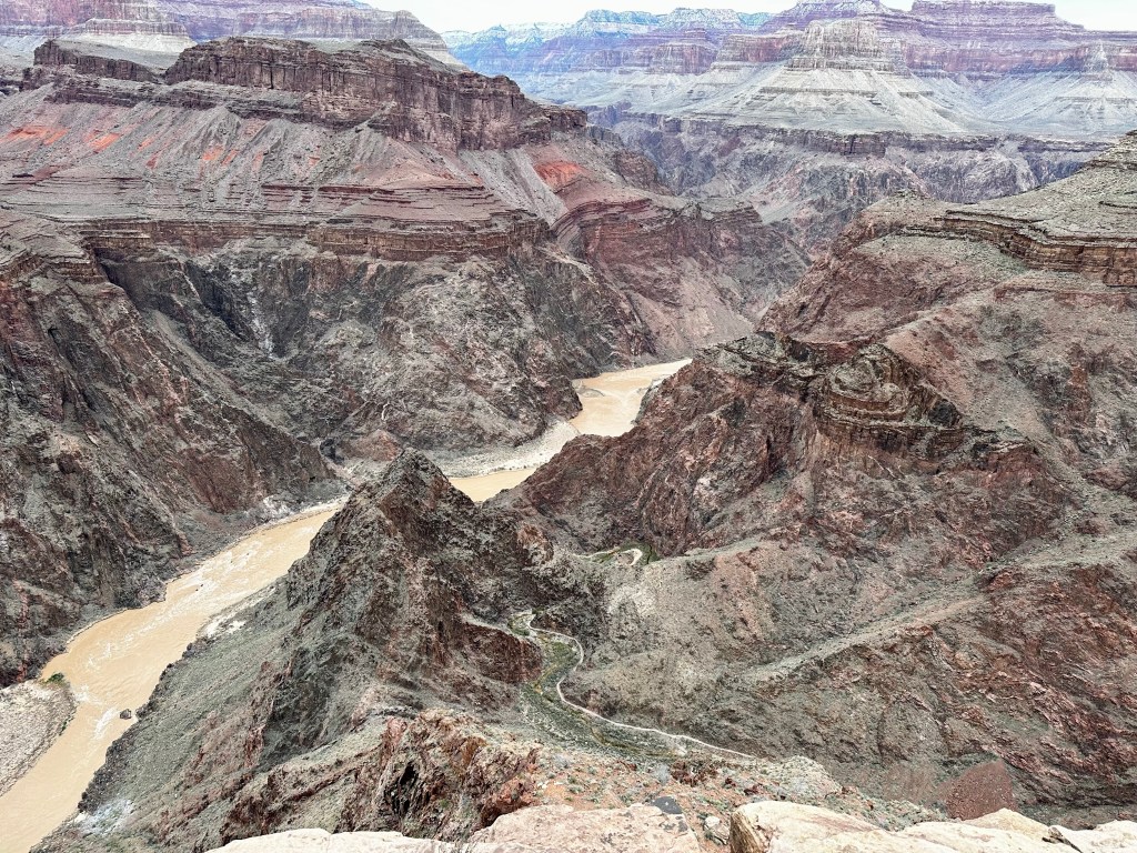
The Tonto plateau runs through the park on both sides of the Colorado river about 3000 feet below the rim and about 2000 feet above the river. We stopped for a rest at the “TipOff”. Which is a junction spot for the So. Kaibab and the Tonto Rim trails. A composting toilet Bathroom break helped, and we removed shoes to check the hot spots on feet. We refreshed the moleskin, dried out socks and headed on down.
Around that limestone bluff we just hiked downYep. Still some mud hereThe Tip Off and gorge beyond.
On the trail over 5+ hours now, we “tip off” into the gorge down switchbacks and really fun areas. Trail is in good shape. we snack during the down-hike. Me on clif bars, Gu, peanut M&M’s. Sraddha has Kind bars and Gu. We each have 3 liters of water and electrolytes for the 7.2 mile, 4,872 ft elevation drop. There is no water on the trail. My pack weighs 29 lb. Sraddha’s is 19-20.
Our guides, Mandy Lea and Kendrick have about 30 trips into the canyon. Experience has taught them to take care of the details and one of these details is to send down gear as much gear as possible with the mules, which included our sleeping bags and food etc went down earlier and awaited us at Phantom Ranch. This makes such a large difference Mandy led the other 2 people, Jan and David who are faster while Kendrick stayed with us
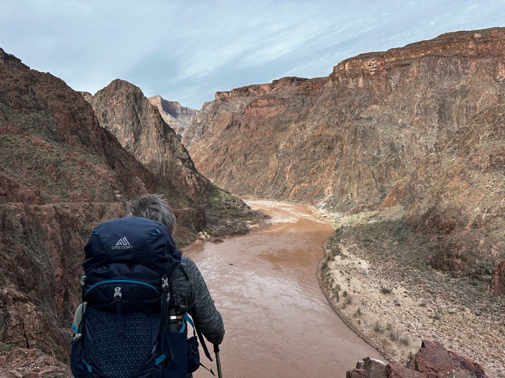
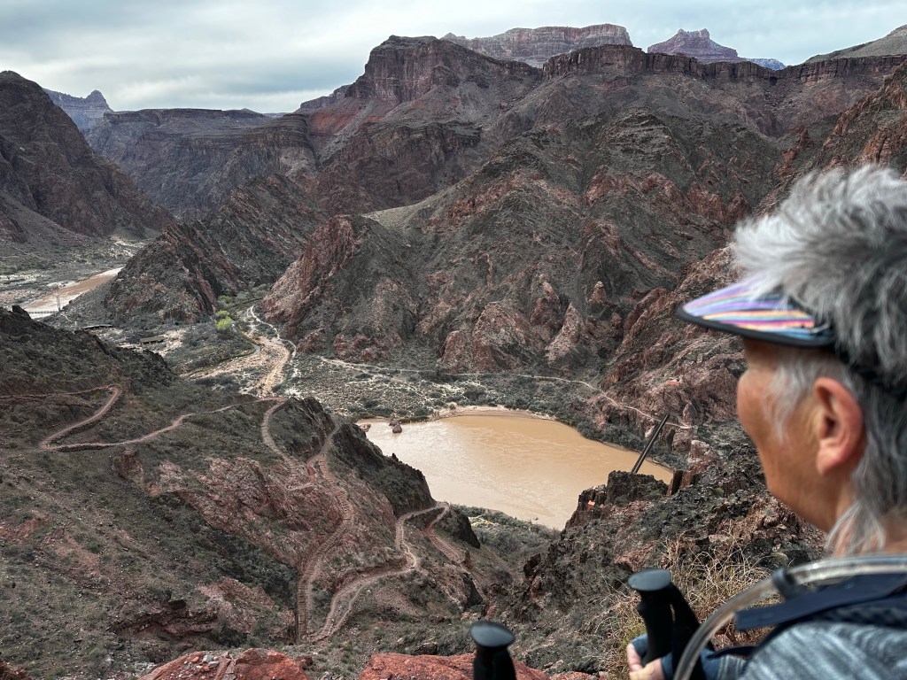
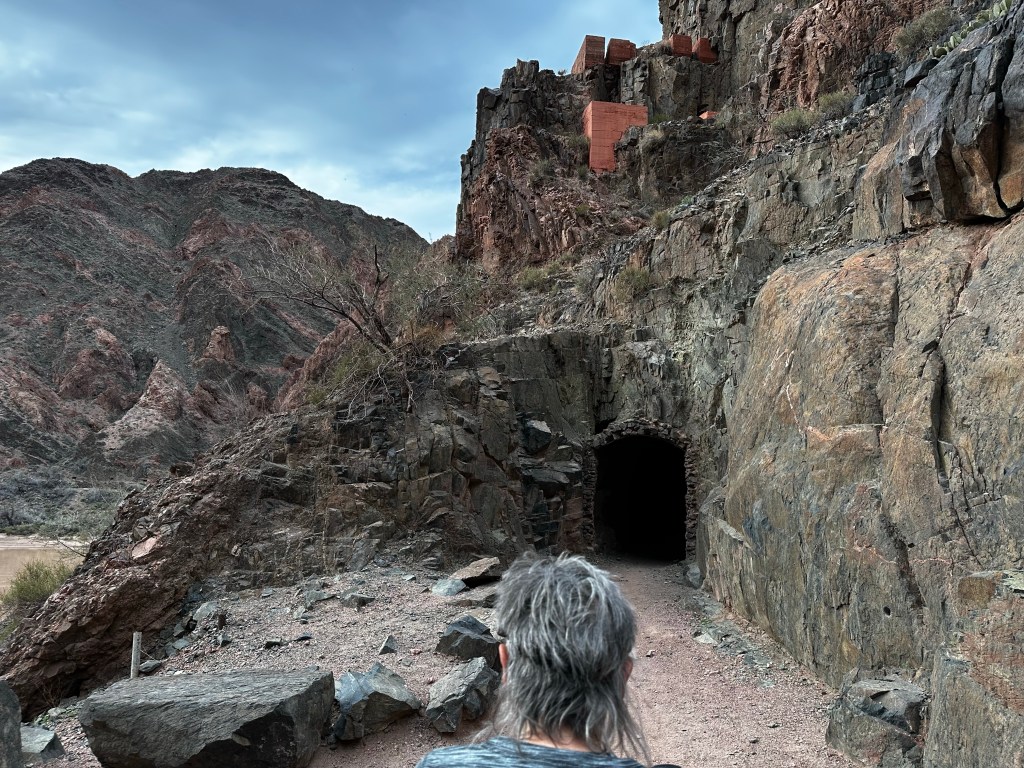
Below the Tonto plateauLooking down the switchbacks and the river. You can see the beach and the canyon up which is Phantom Ranch. 2.5 miles to goTunnel just before Kaibab Suspension Bridge
I didn’t take a lot of photos on the last leg as we were tiring. We made it thru the tunnel, across the suspension bridge and more or less trudged along the river, one…step…at…a…time. We were grateful, exhilarated and super glad we made it to the bottom before sunset. About 9 hours, 7.2 miles, 20,000 steps and 4,872 feet below the rim.
Soon to be sunset on Colorado River. The tents are for a conservation corps crew working on the trail. Not a great photo due to sun in distance creating shadows but, well you get the idea.
We camped at the Bright Angel Campground right near the confluence of the Bright Angel creek descending from the north rim and the Colorado river. Phantom Ranch itself is about 1/3 mile up the creek from the river. (so-to-speak). More about that later. We set up camp and ate, grateful we made it safely and more or less sanely.
Campsite at Bright Angel Campground. Dinner, just add hot water, stir and wait and wait and wait. The “Spork”, a combination for fork and spoon. Long version to dip down into and stir dinner
Daytime temp in mid 60’s and night time the low-mid 40’s. Most importantly the whole hike was in dry weather. I can’t stress enough how much this made our trip enjoyable. The previous week’s trip, our guides tell us, was colder, and much wetter. That’s a story for another day. Let’s just say we felt blessed.
Hopefully, i can find the time to make a shorter post about day 2 tomorrow. If you reached this “low point” 🙄. I urge you to subscribe to future posts on my home page and also leave any comments or questions. I will respond. I am not a big social media person, but it helps to know people read this.
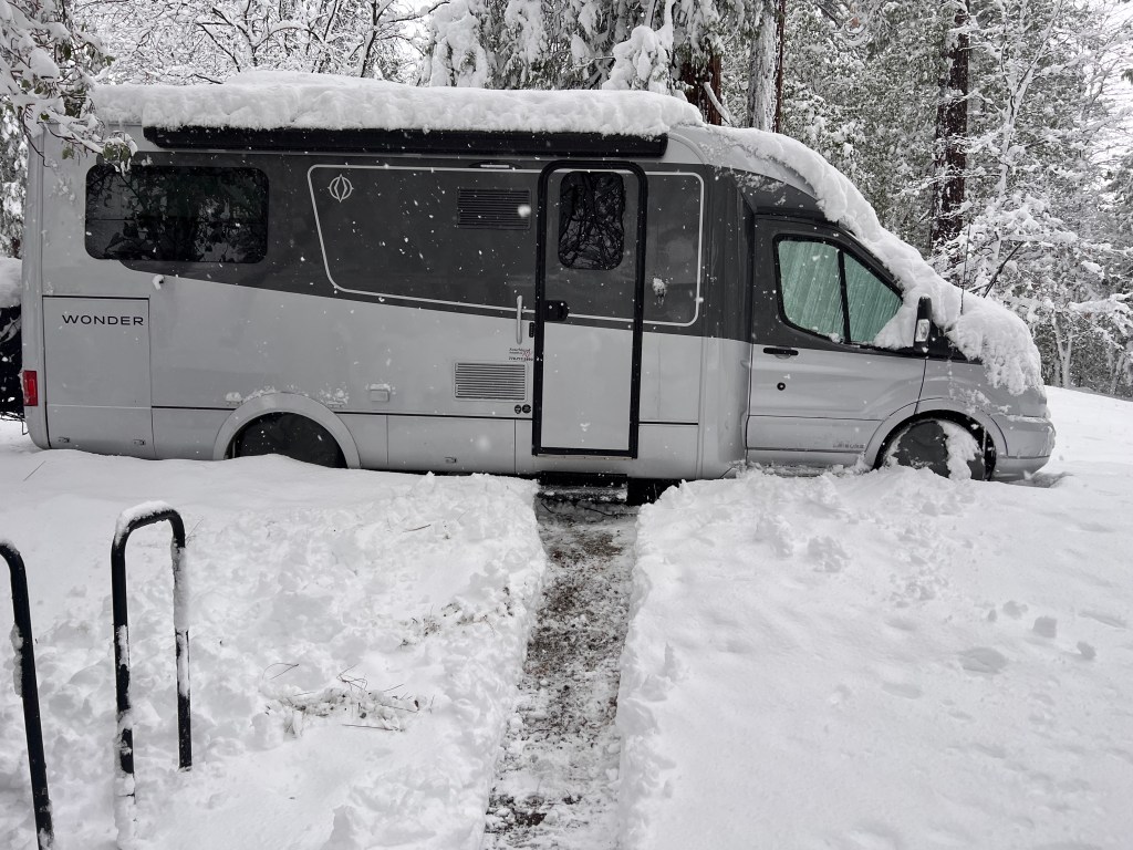
Yesterday, we headed out late morning after a 2 day dig in the snow. We made it to Orange Grove RV park just south of Bakersfield by 7 o’clock. Enroute to the Grand Canyon south rim where we plan to spend 4 days hiking down into (and out of).
Digging out
This morning, we walked around the park picking oranges (yes, it isan Orange grove) with my cousin, who rendezvoused with us there on his route north. Fun to see them. Rving in their 80’s and had delicious oranges too
We proceeded east over Tehachapi via Barstow to Amboy crater.
We stopped in Barstow for fuel and had a “Barstow Walmart“ experience. Hard to describe that in an email, you had to be there.
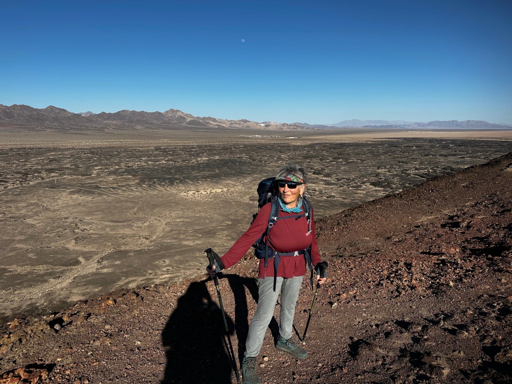
Amboy crater is on the eastern side of the Mojave desert on the old route 66 highway,an old cinder cone from many eons ago. We shouldered our canyon backpacks as a little preliminary hike before heading out to the Grand Canyon. 4 miles later we felt pretty confident that we could do the canyon
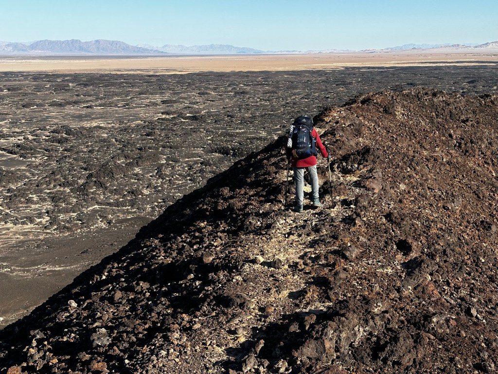
Up on topTreacherous narrow rim. It gets worse.
That’s is that is assuming we could stay upright. Very steep and narrow. Easy without the packs, Treacherous (never again) with.
Now, as the evening sun sets over the Mojave desert, and the golden light illuminates the beautiful boulders and dry landscape, we proceed along the highway down the hill towards the Colorado river atNeedles, California (also known as to us as Noodles,California), where are we will encamp for the night
Tomorrow we head up to the Canyon. We will encamp I’m Trailer village. Hi temp is 40, low is 20 or well 🙈. From experience we think if we keep plugged in with heater on, we will be ok. Daytime above freezing and☀️☀️to warm the van.
Prayers willingly accepted. (Memo to Kent: “what were you thinking when you omitted to this?”)
More later, assuming we don’t get run off the road by sleepy truck drivers on I-40. Ah, the life.