
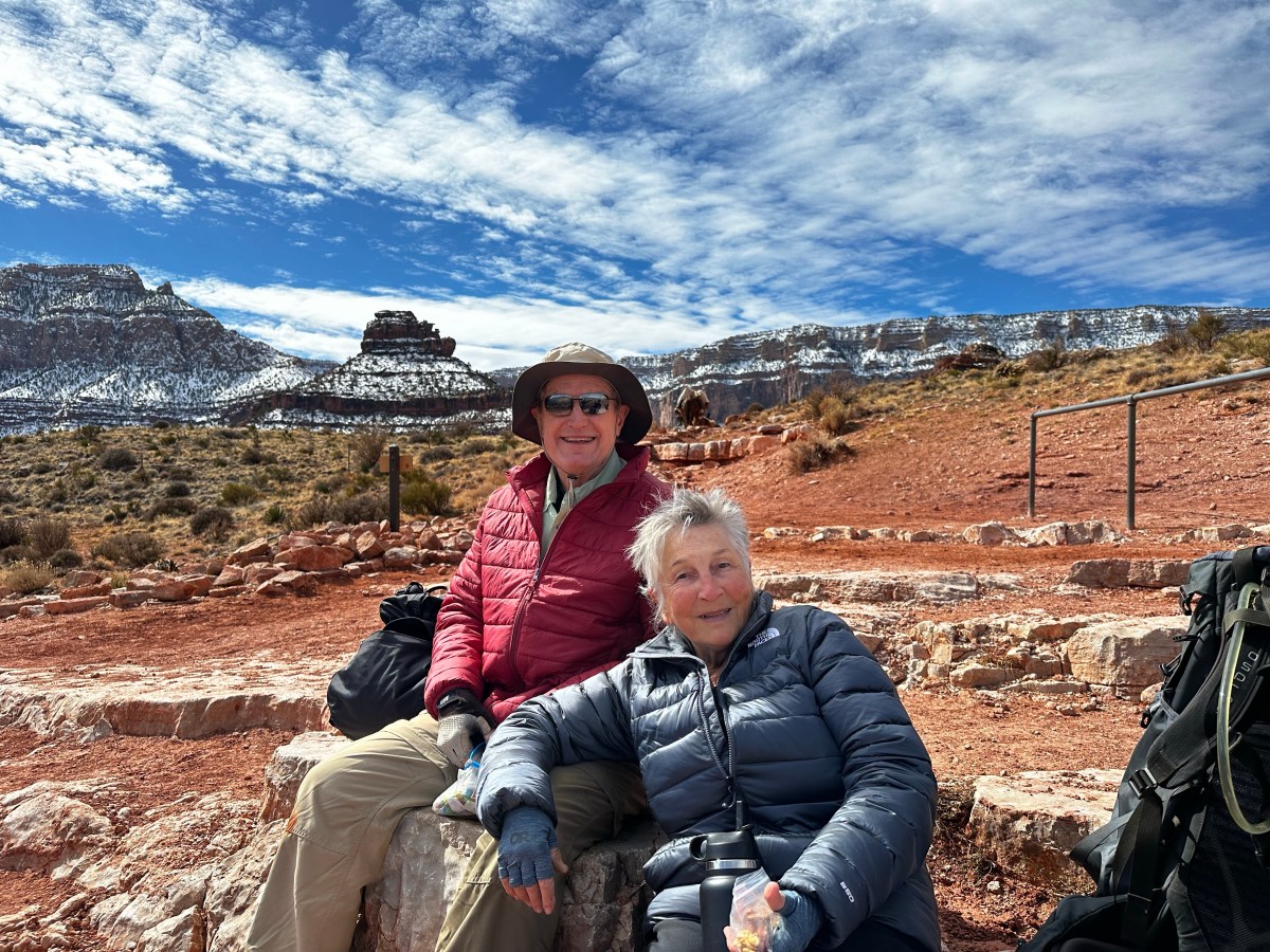
We spent 4 days hiking into and out of the Grand Canyon with 4 other people. 2 guides, Mandy Lea and Kendrick, and 2 wonderful people, Jan and David, from Minnesota. It was the first time our guides and taken a whole group of folks over 70 years of age! Each day will have its own flavor and blog post.
South Kaibab Trail begins near Yaki point just a mile or so east of the visitors center. We camped at Trailer village with hookups to ensure heat in our van while on the hike, since the south rim temps were forecasted to be from 22-39 F. A big snow storm has blanketed the rim the prior week.
NOTE: this is a long post.At least look at photos. Click on them to expand.

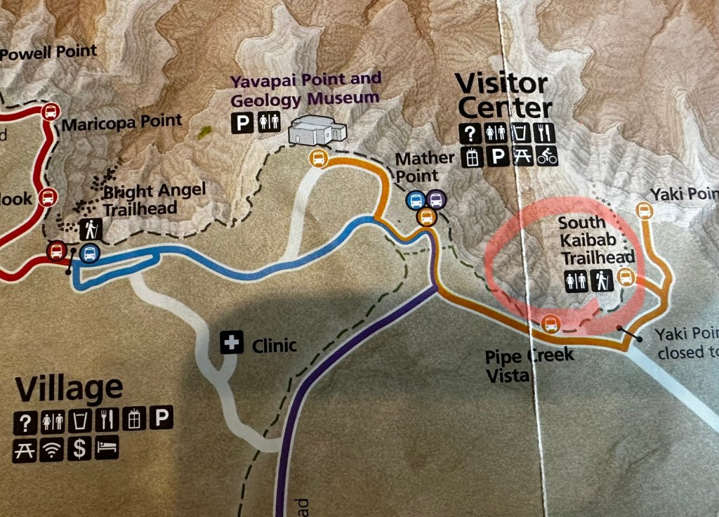
We took the blue line shuttle from camp at 6 AM to meet our group at the Backcountry Info Center on the west end of village. Grabbing a coffee at nearby Maswik Lodge, we board, at 7AM, the “Hiker Express” shuttle directly to Kaibab trailhead on the east end. See maps above with red circled areas.

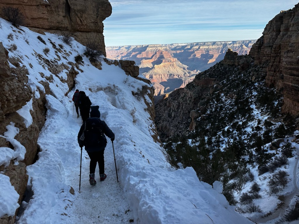
A sense of anticipation was building. We had hiked the first mile or so down to Ooh Aah point last fall and before during dry season, but ice and snow is a different cat on a steep downhill trail. Dangerous and slippery, we tried to stick to the uphill side of the trail.

Knowing there was snow/ice we were using Kahtoola micro-spikes which slip over our boots and provide stability down the series of steep north facing switchbacks to Ooh-Aah point and on down 1.5 miles to Cedar Ridge where we rested. Below this was mud, ice and mud-ice or “mice” in which we slipped a bit. Ask me about it. Needless to say we should left spikes on for another half mile. We continued down a good trail (except for the mud) to Skeleton Point, about 2.7 miles and 2,027 ft below the rim.


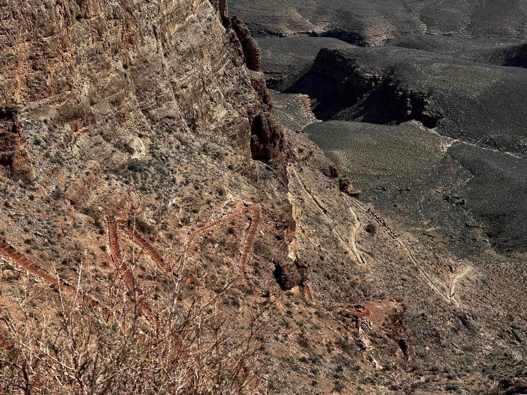
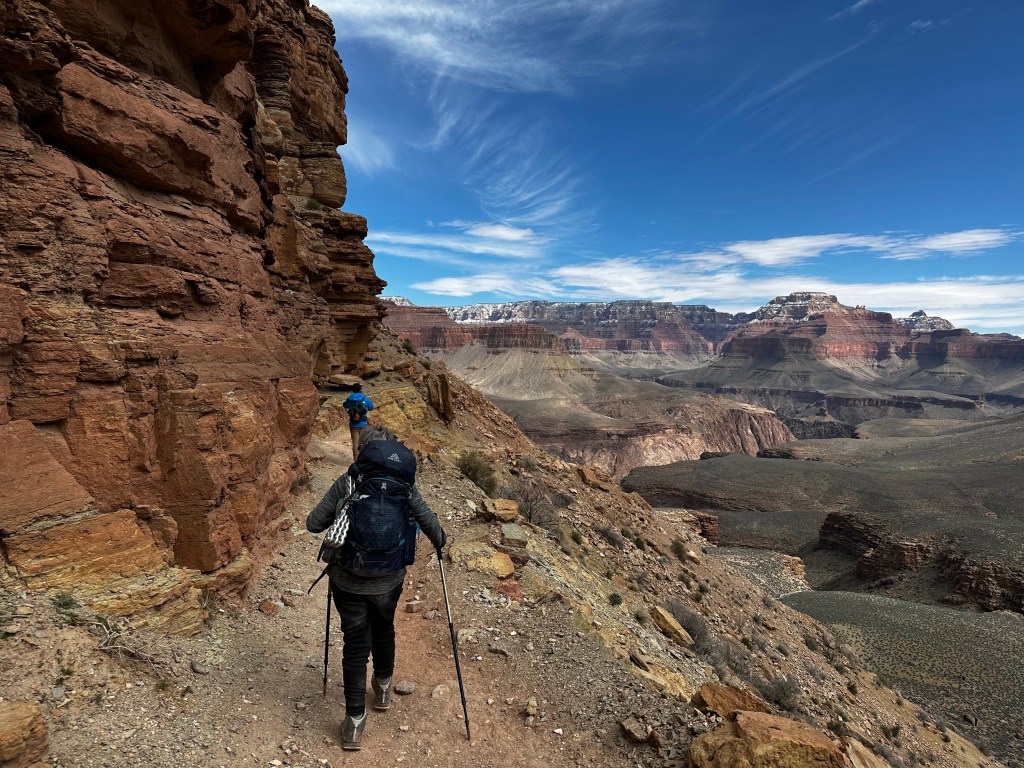
The next leg was down a very steep, rugged switchback called the “Red & White’s”on a trail blasted out of limestone cliffs, down to the Tonto Plateau. 4.5 miles and 3,200 ft below the rim. It’s called the “Red & Whites” because the limestone is white, however it is tinted red from all the other minerals and rocks around it. It was challenging but we made it down safely.

The Tonto plateau runs through the park on both sides of the Colorado river about 3000 feet below the rim and about 2000 feet above the river. We stopped for a rest at the “TipOff”. Which is a junction spot for the So. Kaibab and the Tonto Rim trails. A composting toilet Bathroom break helped, and we removed shoes to check the hot spots on feet. We refreshed the moleskin, dried out socks and headed on down.


On the trail over 5+ hours now, we “tip off” into the gorge down switchbacks and really fun areas. Trail is in good shape. we snack during the down-hike. Me on clif bars, Gu, peanut M&M’s. Sraddha has Kind bars and Gu. We each have 3 liters of water and electrolytes for the 7.2 mile, 4,872 ft elevation drop. There is no water on the trail. My pack weighs 29 lb. Sraddha’s is 19-20.
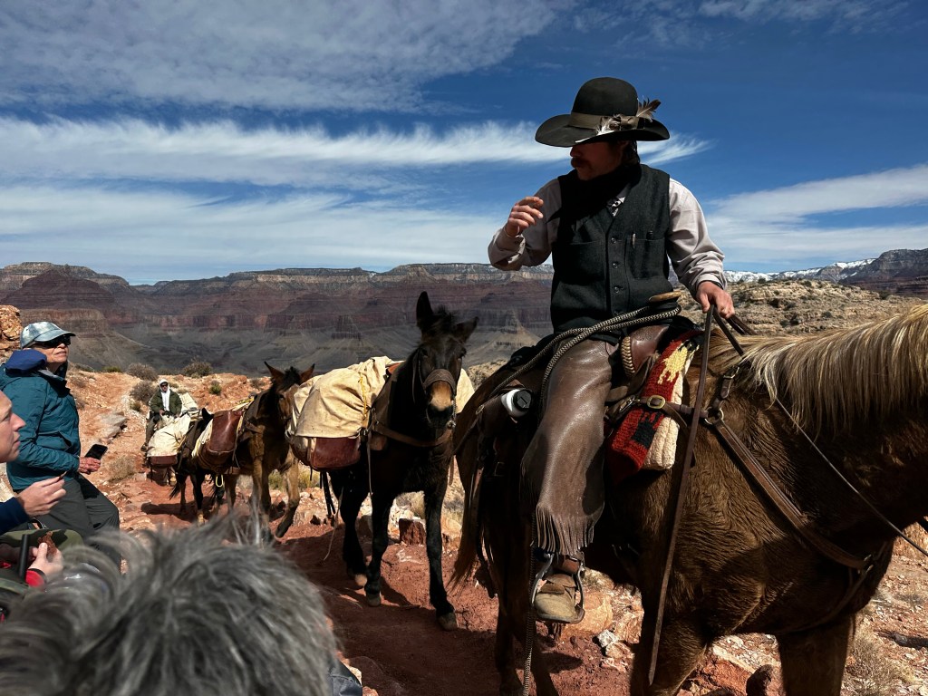
Our guides, Mandy Lea and Kendrick have about 30 trips into the canyon. Experience has taught them to take care of the details and one of these details is to send down gear as much gear as possible with the mules, which included our sleeping bags and food etc went down earlier and awaited us at Phantom Ranch. This makes such a large difference Mandy led the other 2 people, Jan and David who are faster while Kendrick stayed with us

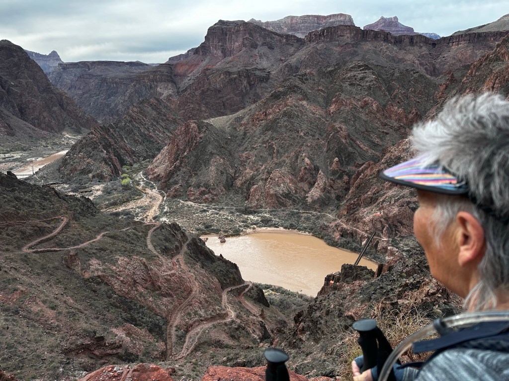
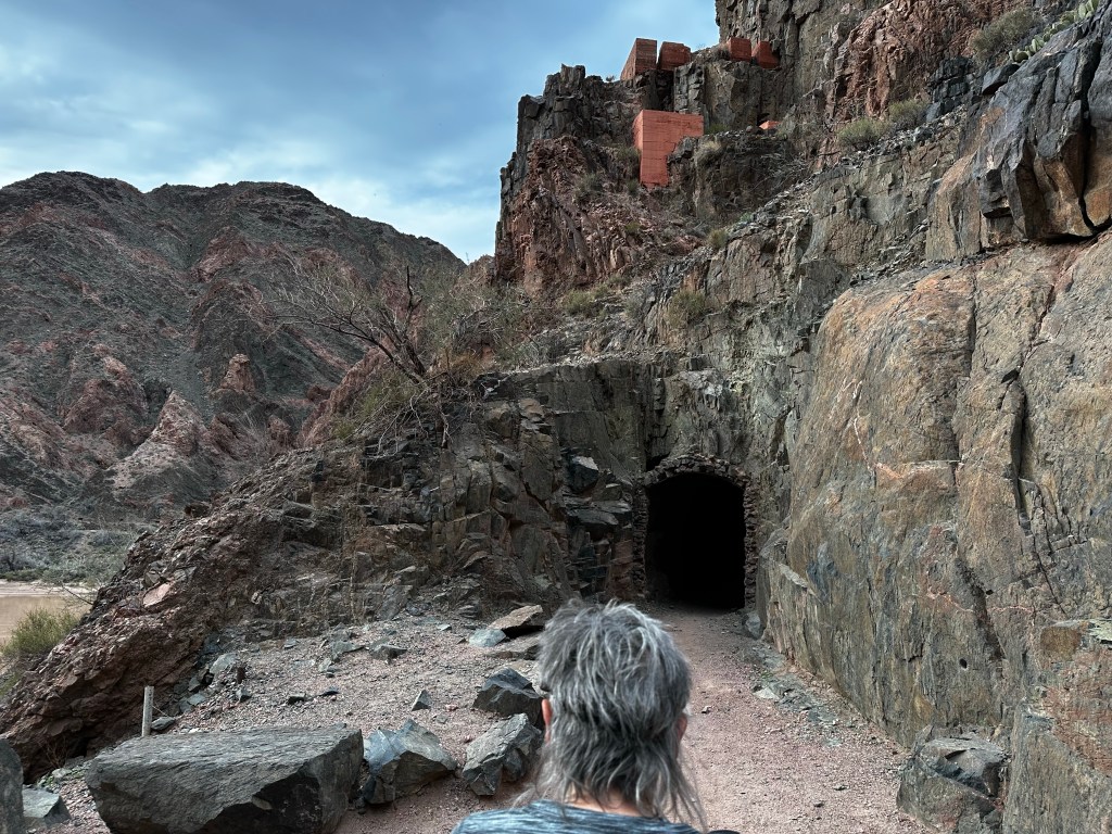
I didn’t take a lot of photos on the last leg as we were tiring. We made it thru the tunnel, across the suspension bridge and more or less trudged along the river, one…step…at…a…time. We were grateful, exhilarated and super glad we made it to the bottom before sunset. About 9 hours, 7.2 miles, 20,000 steps and 4,872 feet below the rim.

We camped at the Bright Angel Campground right near the confluence of the Bright Angel creek descending from the north rim and the Colorado river. Phantom Ranch itself is about 1/3 mile up the creek from the river. (so-to-speak). More about that later. We set up camp and ate, grateful we made it safely and more or less sanely.


Daytime temp in mid 60’s and night time the low-mid 40’s. Most importantly the whole hike was in dry weather. I can’t stress enough how much this made our trip enjoyable. The previous week’s trip, our guides tell us, was colder, and much wetter. That’s a story for another day. Let’s just say we felt blessed.
Hopefully, i can find the time to make a shorter post about day 2 tomorrow. If you reached this “low point” 🙄. I urge you to subscribe to future posts on my home page and also leave any comments or questions. I will respond. I am not a big social media person, but it helps to know people read this.

Wow this is really impressive! What a blessing you that you had dry weather too. 🙏🏻
Thanks for the write up and photos!
LikeLiked by 1 person
You are most welcome
LikeLike
Really enjoyed your description and the beautiful photos. Can hardly wait for Day two.
LikeLiked by 1 person
Soon
LikeLike
Amazing pictures and story, Kent and Sraddha! I’m thrilled you had such a fantastic trip.
LikeLiked by 1 person
Thanks
LikeLike
Thank you for sharing this Kent. Looking forward to seeing more.
LikeLiked by 1 person
Soon
LikeLike
Love this photo with the snow all around! It’s amazing that you were able to do this! So glad the weather cooperated, and that you made it across the snow & mud ok with the packs etc. It was a great effort and from your photos you are sharing the rewards of those efforts! It is inspiring! Blessings on the rest of your trip.
LikeLiked by 1 person
Thanks
LikeLike